Property Information
mobile view
| Serial Number: 49:483:0005 |
Serial Life: 2004-2018 |
|
|

Total Photos: 2
|
| |
|
|
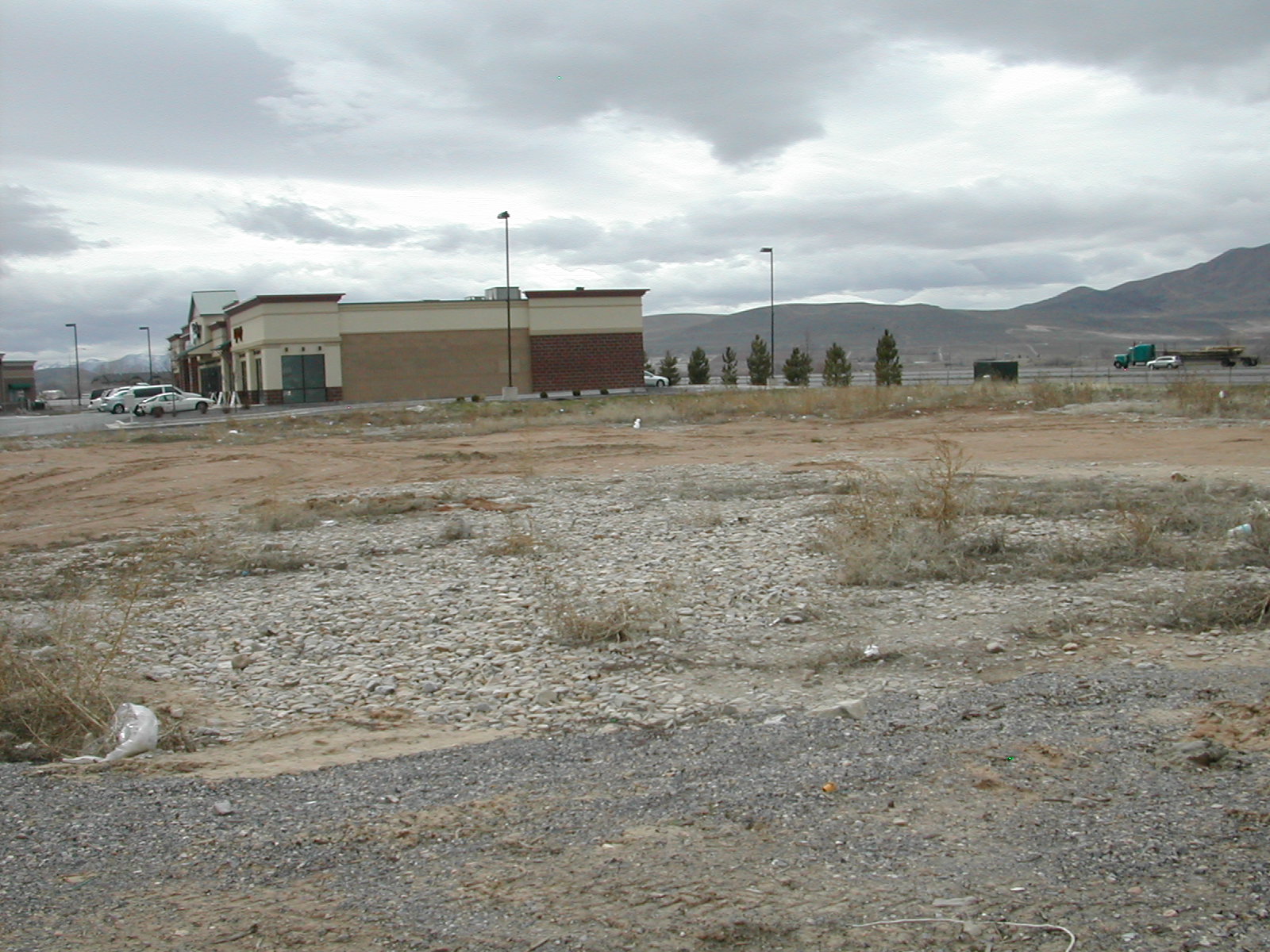
| Property Address: 1342 W TURF FARM WY - PAYSON |
|
| Mailing Address: 199 1ST ST # 212 LOS ALTOS, CA 94022-2767 |
|
| Acreage: 1.117 |
|
| Last Document:
133129-2007
|
|
| Subdivision Map Filing |
|
| Taxing Description:
LOT 5, PAYSON RETAIL SUBDV. AREA 1.117 AC.
*Taxing description NOT FOR LEGAL DOCUMENTS
|
|
- Owner Names
- Value History
- Tax History
- Location
- Photos
- Documents
- Aerial Image
| |
----- Real Estate Values ----- |
---Improvements--- |
---Greenbelt--- |
Total |
| Year |
Com |
Res |
Agr |
Tot |
Com |
Res |
Agr |
Tot |
Land |
Homesite |
Tot |
Market Value |
| 2018 |
$450,100 |
$0 |
$0 |
$450,100 |
$0 |
$0 |
$0 |
$0 |
$0 |
$0 |
$0 |
$450,100 |
| 2017 |
$433,000 |
$0 |
$0 |
$433,000 |
$0 |
$0 |
$0 |
$0 |
$0 |
$0 |
$0 |
$433,000 |
| 2016 |
$408,700 |
$0 |
$0 |
$408,700 |
$0 |
$0 |
$0 |
$0 |
$0 |
$0 |
$0 |
$408,700 |
| 2015 |
$389,300 |
$0 |
$0 |
$389,300 |
$0 |
$0 |
$0 |
$0 |
$0 |
$0 |
$0 |
$389,300 |
| 2014 |
$349,000 |
$0 |
$0 |
$349,000 |
$0 |
$0 |
$0 |
$0 |
$0 |
$0 |
$0 |
$349,000 |
| 2013 |
$326,144 |
$0 |
$0 |
$326,144 |
$0 |
$0 |
$0 |
$0 |
$0 |
$0 |
$0 |
$326,144 |
| 2012 |
$326,144 |
$0 |
$0 |
$326,144 |
$0 |
$0 |
$0 |
$0 |
$0 |
$0 |
$0 |
$326,144 |
| 2011 |
$326,144 |
$0 |
$0 |
$326,144 |
$0 |
$0 |
$0 |
$0 |
$0 |
$0 |
$0 |
$326,144 |
| 2010 |
$326,144 |
$0 |
$0 |
$326,144 |
$0 |
$0 |
$0 |
$0 |
$0 |
$0 |
$0 |
$326,144 |
| 2009 |
$332,800 |
$0 |
$0 |
$332,800 |
$0 |
$0 |
$0 |
$0 |
$0 |
$0 |
$0 |
$332,800 |
| 2008 |
$234,200 |
$0 |
$0 |
$234,200 |
$0 |
$0 |
$0 |
$0 |
$0 |
$0 |
$0 |
$234,200 |
| 2007 |
$234,200 |
$0 |
$0 |
$234,200 |
$0 |
$0 |
$0 |
$0 |
$0 |
$0 |
$0 |
$234,200 |
| 2006 |
$195,148 |
$0 |
$0 |
$195,148 |
$0 |
$0 |
$0 |
$0 |
$0 |
$0 |
$0 |
$195,148 |
| 2005 |
$195,148 |
$0 |
$0 |
$195,148 |
$0 |
$0 |
$0 |
$0 |
$0 |
$0 |
$0 |
$195,148 |
| 2004 |
$195,148 |
$0 |
$0 |
$195,148 |
$0 |
$0 |
$0 |
$0 |
$0 |
$0 |
$0 |
$195,148 |
| Year |
General Taxes |
Adjustments |
Net Taxes |
Fees |
Payments |
Tax Balance* |
Balance Due |
Tax District |
| 2018 |
$5,258.52 |
$0.00 |
$5,258.52 |
$0.00 |
|
$0.00
|
$0.00 |
170 - PAYSON CITY |
| 2017 |
$5,173.05 |
$0.00 |
$5,173.05 |
$0.00 |
|
$0.00
|
$0.00 |
170 - PAYSON CITY |
| 2016 |
$4,915.03 |
$0.00 |
$4,915.03 |
$0.00 |
|
$0.00
|
$0.00 |
170 - PAYSON CITY |
| 2015 |
$4,714.03 |
$0.00 |
$4,714.03 |
$0.00 |
|
$0.00
|
$0.00 |
170 - PAYSON CITY |
| 2014 |
$4,195.68 |
$0.00 |
$4,195.68 |
$0.00 |
|
$0.00
|
$0.00 |
170 - PAYSON CITY |
| 2013 |
$4,104.20 |
$0.00 |
$4,104.20 |
$0.00 |
|
$0.00
|
$0.00 |
170 - PAYSON CITY |
| 2012 |
$4,166.16 |
$0.00 |
$4,166.16 |
$0.00 |
|
$0.00
|
$0.00 |
170 - PAYSON CITY |
| 2011 |
$4,067.34 |
$0.00 |
$4,067.34 |
$0.00 |
|
$0.00
|
$0.00 |
170 - PAYSON CITY |
| 2010 |
$3,965.91 |
$0.00 |
$3,965.91 |
$0.00 |
|
$0.00
|
$0.00 |
170 - PAYSON CITY |
| 2009 |
$3,832.86 |
$0.00 |
$3,832.86 |
$0.00 |
|
$0.00
|
$0.00 |
170 - PAYSON CITY |
| 2008 |
$2,508.98 |
$0.00 |
$2,508.98 |
$0.00 |
|
$0.00
|
$0.00 |
170 - PAYSON CITY |
| 2007 |
$2,488.61 |
$0.00 |
$2,488.61 |
$0.00 |
|
$0.00
|
$0.00 |
170 - PAYSON CITY |
| 2006 |
$2,304.11 |
$0.00 |
$2,304.11 |
$0.00 |
|
$0.00
|
$0.00 |
170 - PAYSON CITY |
| 2005 |
$2,452.82 |
$0.00 |
$2,452.82 |
$0.00 |
|
$0.00
|
$0.00 |
170 - PAYSON CITY |
| 2004 |
$2,459.65 |
$0.00 |
$2,459.65 |
$0.00 |
|
$0.00
|
$0.00 |
170 - PAYSON CITY |
* Note: Original tax amount (Does not include applicable interest and/or fees).
| Entry # |
Date |
Recorded |
Type |
Party1 (Grantor) |
Party2 (Grantee) |
| 28005-2018 |
03/09/2018 |
03/26/2018 |
SP WD |
HARMAN MANGEMENT CORPORATION (ET AL) |
HARMAN MANAGEMENT CORPORATION |
| 3187-2015 |
12/04/2014 |
01/14/2015 |
QCD |
UNITED STATES OF AMERICA |
SOUTH UTAH VALLEY ELECTRIC SERVICE DISTRICT |
| 114949-2008 |
10/20/2008 |
10/22/2008 |
CT |
STATE OF UTAH |
WHOM OF INTEREST |
| 107508-2008 |
09/30/2008 |
09/30/2008 |
RESOL |
BOARD OF COUNTY COMMISSIONERS UTAH COUNTY |
WHOM OF INTEREST |
| 133129-2007 |
08/30/2007 |
09/11/2007 |
SP WD |
WAL-MART STORES INC |
HARMAN MANAGEMENT CORPORATION |
| 17577-2007 |
01/31/2007 |
02/02/2007 |
EAS |
WAL-MART STORES INC |
STARBUCKS CORPORATION |
| 143732-2006 |
08/31/2006 |
10/27/2006 |
EAS |
WAL-MART STORES INC |
CITY OF PAYSON |
| 27093-2005 |
12/21/2004 |
03/15/2005 |
QCD |
WAL MART STORES INC |
WAL MART STORES INC |
| 67853-2003 |
05/05/2003 |
05/06/2003 |
NOT COM |
CAMCO CONSTRUCTION INC (ET AL) |
WAL MART STORES INC |
| 39195-2003 |
12/18/2002 |
03/17/2003 |
S PLAT |
WAL MART STORES INC |
PAYSON RETAIL |
Main Menu Comments or Concerns on Value/Appraisal - Assessor's Office
Documents/Owner/Parcel information - Recorder's Office
Address Change for Tax Notice
This page was created on 5/22/2024 11:28:36 PM |