Property Information
| Serial Number: 46:962:0003 |
Serial Life: 2017... |
|
|
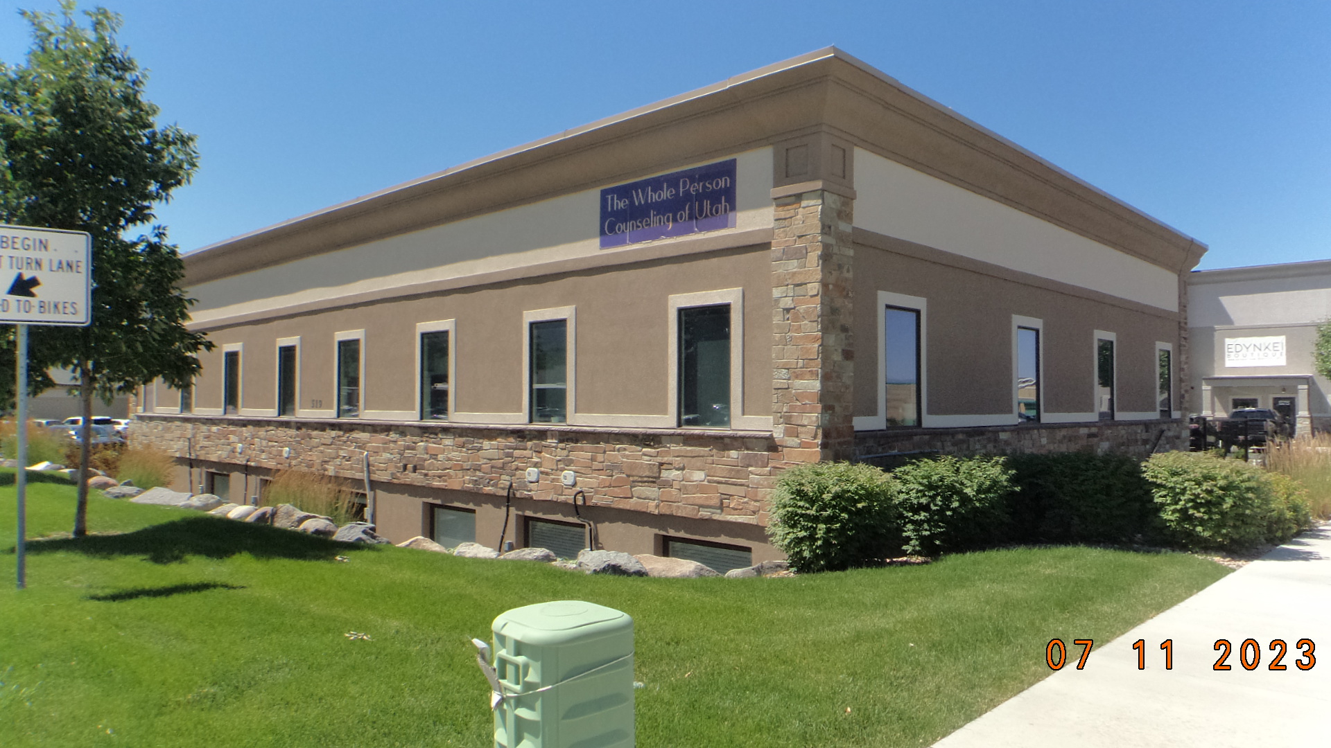
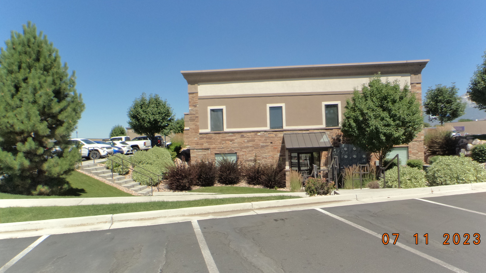 Total Photos: 2
|
| |
|
|
| Property Address: 519 W STATE ST Unit# J-103 - PLEASANT GROVE |
|
| Mailing Address: 952 N FORT CANYON RD ALPINE, UT 84004-1134 |
|
| Acreage: 0.024743 |
|
| Last Document:
47134-2020
|
|
| Subdivision Map Filing |
|
| Taxing Description:
UNIT J-103, PLAT E, MAJESTIC MEADOWS CONDOS SUB. AREA 0.025 AC.
*Taxing description NOT FOR LEGAL DOCUMENTS
|
|
- Owner Names
- Value History
- Tax History
- Location
- Photos
- Documents
- Aerial Image
| |
----- Real Estate Values ----- |
---Improvements--- |
---Greenbelt--- |
Total |
| Year |
Com |
Res |
Agr |
Tot |
Com |
Res |
Agr |
Tot |
Land |
Homesite |
Tot |
Market Value |
| 2026 |
$32,700 |
$0 |
$0 |
$32,700 |
$130,900 |
$0 |
$0 |
$130,900 |
$0 |
$0 |
$0 |
$163,600 |
| 2025 |
$68,700 |
$0 |
$0 |
$68,700 |
$94,700 |
$0 |
$0 |
$94,700 |
$0 |
$0 |
$0 |
$163,400 |
| 2024 |
$65,400 |
$0 |
$0 |
$65,400 |
$90,200 |
$0 |
$0 |
$90,200 |
$0 |
$0 |
$0 |
$155,600 |
| 2023 |
$64,100 |
$0 |
$0 |
$64,100 |
$88,400 |
$0 |
$0 |
$88,400 |
$0 |
$0 |
$0 |
$152,500 |
| 2022 |
$64,100 |
$0 |
$0 |
$64,100 |
$72,600 |
$0 |
$0 |
$72,600 |
$0 |
$0 |
$0 |
$136,700 |
| 2021 |
$64,100 |
$0 |
$0 |
$64,100 |
$72,600 |
$0 |
$0 |
$72,600 |
$0 |
$0 |
$0 |
$136,700 |
| 2020 |
$64,100 |
$0 |
$0 |
$64,100 |
$72,600 |
$0 |
$0 |
$72,600 |
$0 |
$0 |
$0 |
$136,700 |
| 2019 |
$64,100 |
$0 |
$0 |
$64,100 |
$62,100 |
$0 |
$0 |
$62,100 |
$0 |
$0 |
$0 |
$126,200 |
| 2018 |
$42,700 |
$0 |
$0 |
$42,700 |
$83,500 |
$0 |
$0 |
$83,500 |
$0 |
$0 |
$0 |
$126,200 |
| 2017 |
$40,400 |
$0 |
$0 |
$40,400 |
$46,900 |
$0 |
$0 |
$46,900 |
$0 |
$0 |
$0 |
$87,300 |
| Year |
General Taxes |
Adjustments |
Net Taxes |
Fees |
Payments |
Tax Balance* |
Balance Due |
Tax Area |
| 2027 |
$0.00 |
$0.00 |
$0.00 |
$0.00 |
|
$0.00
|
$0.00 |
070 - PLEASANT GROVE CITY |
| 2026 |
$1,400.91 |
$0.00 |
$1,400.91 |
$0.00 |
|
|
Click for Payoff
|
070 - PLEASANT GROVE CITY |
| 2025 |
$1,369.78 |
$0.00 |
$1,369.78 |
$0.00 |
|
$0.00
|
$0.00 |
070 - PLEASANT GROVE CITY |
| 2024 |
$1,333.34 |
$0.00 |
$1,333.34 |
$0.00 |
|
$0.00
|
$0.00 |
070 - PLEASANT GROVE CITY |
| 2023 |
$1,248.21 |
($28.97) |
$1,219.24 |
$0.00 |
|
$0.00
|
$0.00 |
070 - PLEASANT GROVE CITY |
| 2022 |
$1,124.49 |
$0.00 |
$1,124.49 |
$0.00 |
|
$0.00
|
$0.00 |
070 - PLEASANT GROVE CITY |
| 2021 |
$1,342.80 |
$0.00 |
$1,342.80 |
$0.00 |
|
$0.00
|
$0.00 |
070 - PLEASANT GROVE CITY |
| 2020 |
$1,369.73 |
$0.00 |
$1,369.73 |
$0.00 |
|
$0.00
|
$0.00 |
070 - PLEASANT GROVE CITY |
| 2019 |
$1,222.75 |
$0.00 |
$1,222.75 |
$0.00 |
|
$0.00
|
$0.00 |
070 - PLEASANT GROVE CITY |
| 2018 |
$1,293.17 |
$0.00 |
$1,293.17 |
$0.00 |
|
$0.00
|
$0.00 |
070 - PLEASANT GROVE CITY |
| 2017 |
$924.16 |
$0.00 |
$924.16 |
$0.00 |
|
$0.00
|
$0.00 |
070 - PLEASANT GROVE CITY |
* Note: Original tax amount (Does not include applicable interest and/or fees).
| Entry # |
Date |
Recorded |
Type |
Party1 (Grantor) |
Party2 (Grantee) |
| 47134-2020 |
02/05/2020 |
04/10/2020 |
WD |
FORT CANYON PARTNERS II LLC |
R&M FAMILY INVESTMENTS III LLC |
| 113978-2017 |
10/13/2017 |
11/17/2017 |
REC |
BANK OF AMERICAN FORK TEE |
AA DEVELOPMENT INC |
| 699-2017 |
01/03/2017 |
01/04/2017 |
WD |
AA DEVELOPMENT INC |
FORT CANYON PARTNERS II LLC |
| 105260-2016 |
10/20/2016 |
10/20/2016 |
DECLSUP |
AA DEVELOPMENT INC |
WHOM OF INTEREST |
| 105259-2016 |
08/02/2016 |
10/20/2016 |
C PLAT |
AA DEVELOPMENT INC |
MAJESTIC MEADOWS CONDOMINIUMS PLAT E |
Main Menu Comments or Concerns on Value/Appraisal - Assessor's Office
Documents/Owner/Parcel information - Recorder's Office
Address Change for Tax Notice
This page was created on 10/21/2026 4:20:38 AM |