Property Information
mobile view
| Serial Number: 29:025:0073 |
Serial Life: 1999-2000 |
|
|
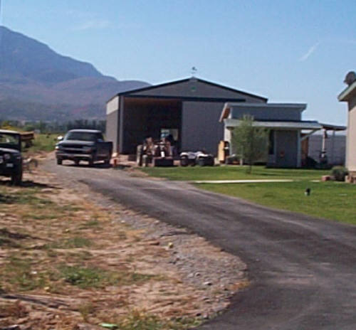
Total Photos: 2
|
| |
|
|
| Property Address: |
|
| Mailing Address: 5121 W 12400 S PAYSON, UT 84651-3606 |
|
| Acreage: 9.500131 |
|
| Last Document:
68061-1998
|
|
| Subdivision Map Filing |
|
| Taxing Description:
COM N 1994.57 FT & W 20.97 FT FR S 1/4 COR. SEC. 25 T9S R1E SLB&M.; N 0 DEG 36' 9" W 627.04 FT; N 89 DEG 23' 51" E 659.69 FT; S 633.94 FT; W 653.06 FT TO BEG. AREA 9.500 AC.
*Taxing description NOT FOR LEGAL DOCUMENTS
|
|
- Owner Names
- Value History
- Tax History
- Location
- Photos
- Documents
- Aerial Image
| |
----- Real Estate Values ----- |
---Improvements--- |
---Greenbelt--- |
Total |
| Year |
Com |
Res |
Agr |
Tot |
Com |
Res |
Agr |
Tot |
Land |
Homesite |
Tot |
Market Value |
| 2000 |
$0 |
$0 |
$115,014 |
$115,014 |
$0 |
$0 |
$0 |
$0 |
$6,650 |
$0 |
$6,650 |
$115,014 |
| 1999 |
$0 |
$0 |
$115,014 |
$115,014 |
$0 |
$0 |
$0 |
$0 |
$6,175 |
$0 |
$6,175 |
$115,014 |
| Year |
General Taxes |
Adjustments |
Net Taxes |
Fees |
Payments |
Tax Balance* |
Balance Due |
Tax District |
| 2000 |
$79.30 |
$0.00 |
$79.30 |
$0.00 |
|
$0.00
|
$0.00 |
120 - NEBO SCHOOL DIST S/A 6-7-8 |
| 1999 |
$70.03 |
$0.00 |
$70.03 |
$0.00 |
|
$0.00
|
$0.00 |
120 - NEBO SCHOOL DIST S/A 6-7-8 |
* Note: Original tax amount (Does not include applicable interest and/or fees).
| Entry # |
Date |
Recorded |
Type |
Party1 (Grantor) |
Party2 (Grantee) |
| 72800-2000 |
12/13/2000 |
12/13/2000 |
CORR |
HOGAN, MARK E |
|
| 36727-2000 |
05/09/2000 |
05/09/2000 |
QCD |
BURNINGHAM, GENEVIEVE T (ET AL) |
PINO, JAMES & LAURA |
| 68061-1998 |
07/07/1998 |
07/08/1998 |
WD |
DALEY, DAVID G |
BURNINGHAM, GENEVIEVE T (ET AL) |
Main Menu Comments or Concerns on Value/Appraisal - Assessor's Office
Documents/Owner/Parcel information - Recorder's Office
Address Change for Tax Notice
This page was created on 6/11/2024 5:23:32 PM |
