Property Information
mobile view
| Serial Number: 27:004:0067 |
Serial Life: 2006-2015 |
|
|
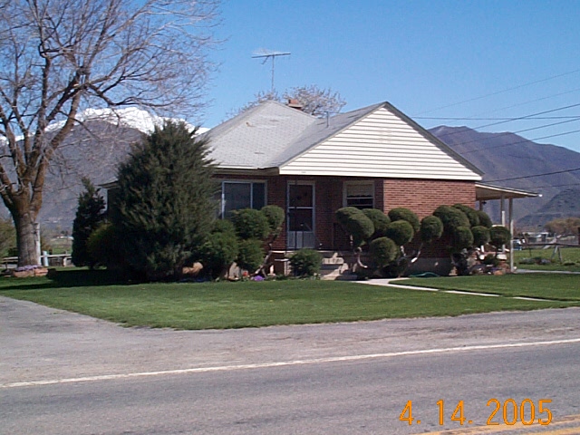
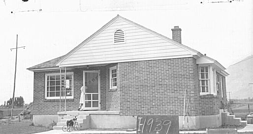
Total Photos: 2
|
| |
|
|
| Property Address: 390 W 800 SOUTH - MAPLETON |
|
| Mailing Address: 390 W 1600 S MAPLETON, UT 84664-4903 |
|
| Acreage: 1.041 |
|
| Last Document:
45578-2015
|
|
| Subdivision Map Filing |
|
| Taxing Description:
COM N 26.45 FT & W 1326.44 FT FR SE COR. SEC. 15 T8S R3E SLB&M.; N 336 FT; N 84 DEG 0' 2" E 132.44 FT; S 0 DEG 10' 0" E 349.65 FT; S 89 DEG 55' 0" W 132.73 FT TO BEG. AREA 1.041 AC.
*Taxing description NOT FOR LEGAL DOCUMENTS
|
|
- Owner Names
- Value History
- Tax History
- Location
- Photos
- Documents
- Aerial Image
| |
----- Real Estate Values ----- |
---Improvements--- |
---Greenbelt--- |
Total |
| Year |
Com |
Res |
Agr |
Tot |
Com |
Res |
Agr |
Tot |
Land |
Homesite |
Tot |
Market Value |
| 2015 |
$0 |
$100,000 |
$2,300 |
$102,300 |
$0 |
$70,500 |
$0 |
$70,500 |
$0 |
$0 |
$0 |
$172,800 |
| 2014 |
$0 |
$100,000 |
$1,400 |
$101,400 |
$0 |
$61,300 |
$0 |
$61,300 |
$0 |
$0 |
$0 |
$162,700 |
| 2013 |
$0 |
$88,000 |
$1,200 |
$89,200 |
$0 |
$61,300 |
$0 |
$61,300 |
$0 |
$0 |
$0 |
$150,500 |
| 2012 |
$0 |
$85,000 |
$1,200 |
$86,200 |
$0 |
$64,400 |
$0 |
$64,400 |
$0 |
$0 |
$0 |
$150,600 |
| 2011 |
$0 |
$85,000 |
$1,200 |
$86,200 |
$0 |
$66,000 |
$0 |
$66,000 |
$0 |
$0 |
$0 |
$152,200 |
| 2010 |
$0 |
$90,000 |
$579 |
$90,579 |
$0 |
$77,453 |
$0 |
$77,453 |
$0 |
$0 |
$0 |
$168,032 |
| 2009 |
$0 |
$107,800 |
$22,000 |
$129,800 |
$0 |
$62,600 |
$0 |
$62,600 |
$0 |
$0 |
$0 |
$192,400 |
| 2008 |
$0 |
$107,800 |
$22,000 |
$129,800 |
$0 |
$62,600 |
$0 |
$62,600 |
$0 |
$0 |
$0 |
$192,400 |
| 2007 |
$0 |
$107,800 |
$22,000 |
$129,800 |
$0 |
$62,600 |
$0 |
$62,600 |
$0 |
$0 |
$0 |
$192,400 |
| 2006 |
$0 |
$98,000 |
$20,000 |
$118,000 |
$0 |
$62,600 |
$0 |
$62,600 |
$0 |
$0 |
$0 |
$180,600 |
| Year |
General Taxes |
Adjustments |
Net Taxes |
Fees |
Payments |
Tax Balance* |
Balance Due |
Tax District |
| 2015 |
$1,302.58 |
$0.00 |
$1,302.58 |
$0.00 |
|
$0.00
|
$0.00 |
140 - MAPLETON CITY |
| 2014 |
$1,244.13 |
$0.00 |
$1,244.13 |
$0.00 |
|
$0.00
|
$0.00 |
140 - MAPLETON CITY |
| 2013 |
$1,224.48 |
$0.00 |
$1,224.48 |
$0.00 |
|
$0.00
|
$0.00 |
140 - MAPLETON CITY |
| 2012 |
$1,253.30 |
$0.00 |
$1,253.30 |
$0.00 |
|
$0.00
|
$0.00 |
140 - MAPLETON CITY |
| 2011 |
$1,239.99 |
$0.00 |
$1,239.99 |
$0.00 |
|
$0.00
|
$0.00 |
140 - MAPLETON CITY |
| 2010 |
$1,325.67 |
$0.00 |
$1,325.67 |
$0.00 |
|
$0.00
|
$0.00 |
140 - MAPLETON CITY |
| 2009 |
$1,549.38 |
$0.00 |
$1,549.38 |
$0.00 |
|
$0.00
|
$0.00 |
140 - MAPLETON CITY |
| 2008 |
$1,411.32 |
($1,143.01) |
$268.31 |
$0.00 |
|
$0.00
|
$0.00 |
140 - MAPLETON CITY |
| 2007 |
$1,320.60 |
($1,069.53) |
$251.07 |
$0.00 |
|
$0.00
|
$0.00 |
140 - MAPLETON CITY |
| 2006 |
$1,337.44 |
($1,090.52) |
$246.92 |
$0.00 |
|
$0.00
|
$0.00 |
140 - MAPLETON CITY |
* Note: Original tax amount (Does not include applicable interest and/or fees).
| Entry # |
Date |
Recorded |
Type |
Party1 (Grantor) |
Party2 (Grantee) |
| 45581-2015 |
05/27/2015 |
05/27/2015 |
BLA |
DUFFIN, JANEAL SUCTEE (ET AL) |
ALLAN, J COLLIN (ET AL) |
| 45578-2015 |
05/21/2015 |
05/27/2015 |
AF DC |
BIRD, RICHARD STANLEY & R STANLEY AKA (ET AL) |
DUFFIN, JANEAL SUCTEE |
| 3187-2015 |
12/04/2014 |
01/14/2015 |
QCD |
UNITED STATES OF AMERICA |
SOUTH UTAH VALLEY ELECTRIC SERVICE DISTRICT |
| 25733-2005 |
03/11/2005 |
03/11/2005 |
QCD |
BIRD, ELIZABETH TEE (ET AL) |
DUNN, MICHAEL RAY & ELLA MARIE |
Main Menu Comments or Concerns on Value/Appraisal - Assessor's Office
Documents/Owner/Parcel information - Recorder's Office
Address Change for Tax Notice
This page was created on 5/23/2024 4:55:46 AM |