Property Information
mobile view
| Serial Number: 02:024:0029 |
Serial Life: 1981-1996 |
|
|
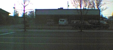
Total Photos: 1
|
| |
|
|
| Property Address: AMERICAN FORK |
|
| Mailing Address: 75 S 300 W AMERICAN FORK, UT 84003-2209 |
|
| Acreage: 0.5 |
|
| Last Document:
29779-1976
|
|
| Subdivision Map Filing |
|
| Taxing Description:
COM. 11 RODS S OF NW COR OF LOT 9, BLK 11, PLAT A, AMERICAN FORK CITY SURVEY; S 9 RODS; E 4 RODS; N 9 RODS; W 4 RODS TO BEG. AREA .23 ACRE.
*Taxing description NOT FOR LEGAL DOCUMENTS
|
|
- Owner Names
- Value History
- Tax History
- Location
- Photos
- Documents
- Aerial Image
| |
----- Real Estate Values ----- |
---Improvements--- |
---Greenbelt--- |
Total |
| Year |
Com |
Res |
Agr |
Tot |
Com |
Res |
Agr |
Tot |
Land |
Homesite |
Tot |
Market Value |
| 1996 |
$15,617 |
$0 |
$0 |
$15,617 |
$0 |
$0 |
$0 |
$0 |
$0 |
$0 |
$0 |
$15,617 |
| 1995 |
$0 |
$0 |
$15,617 |
$15,617 |
$0 |
$0 |
$0 |
$0 |
$0 |
$0 |
$0 |
$15,617 |
| 1994 |
$0 |
$0 |
$9,133 |
$9,133 |
$0 |
$0 |
$0 |
$0 |
$0 |
$0 |
$0 |
$9,133 |
| 1993 |
$0 |
$0 |
$9,133 |
$9,133 |
$0 |
$0 |
$0 |
$0 |
$0 |
$0 |
$0 |
$9,133 |
| 1992 |
$0 |
$0 |
$8,379 |
$8,379 |
$0 |
$0 |
$0 |
$0 |
$0 |
$0 |
$0 |
$8,379 |
| 1991 |
$0 |
$0 |
$7,350 |
$7,350 |
$0 |
$0 |
$0 |
$0 |
$0 |
$0 |
$0 |
$7,350 |
| 1990 |
$0 |
$0 |
$7,350 |
$7,350 |
$0 |
$0 |
$0 |
$0 |
$0 |
$0 |
$0 |
$7,350 |
| 1989 |
$0 |
$0 |
$7,350 |
$7,350 |
$0 |
$0 |
$0 |
$0 |
$0 |
$0 |
$0 |
$7,350 |
| 1988 |
$0 |
$0 |
$7,350 |
$7,350 |
$0 |
$0 |
$0 |
$0 |
$0 |
$0 |
$0 |
$7,350 |
| 1987 |
$0 |
$0 |
$7,350 |
$7,350 |
$0 |
$0 |
$0 |
$0 |
$0 |
$0 |
$0 |
$7,350 |
| 1986 |
$0 |
$0 |
$10,613 |
$10,613 |
$0 |
$0 |
$0 |
$0 |
$0 |
$0 |
$0 |
$10,613 |
| 1985 |
$0 |
$0 |
$10,613 |
$10,613 |
$0 |
$0 |
$0 |
$0 |
$0 |
$0 |
$0 |
$10,613 |
| 1984 |
$0 |
$0 |
$10,719 |
$10,719 |
$0 |
$0 |
$0 |
$0 |
$0 |
$0 |
$0 |
$10,719 |
| Year |
General Taxes |
Adjustments |
Net Taxes |
Fees |
Payments |
Tax Balance* |
Balance Due |
Tax District |
| 1996 |
$163.73 |
$0.00 |
$163.73 |
$0.00 |
|
$0.00
|
$0.00 |
060 - AMERICAN FORK CITY |
| 1995 |
$182.95 |
$0.00 |
$182.95 |
$0.00 |
|
$0.00
|
$0.00 |
060 - AMERICAN FORK CITY |
| 1994 |
$136.42 |
$0.00 |
$136.42 |
$0.00 |
|
$0.00
|
$0.00 |
060 - AMERICAN FORK CITY |
| 1993 |
$116.72 |
$0.00 |
$116.72 |
$0.00 |
|
$0.00
|
$0.00 |
060 - AMERICAN FORK CITY |
| 1992 |
$110.81 |
$0.00 |
$110.81 |
$0.00 |
|
$0.00
|
$0.00 |
060 - AMERICAN FORK CITY |
| 1991 |
$94.93 |
$0.00 |
$94.93 |
$0.00 |
|
$0.00
|
$0.00 |
060 - AMERICAN FORK CITY |
| 1990 |
$85.29 |
$0.00 |
$85.29 |
$0.00 |
|
$0.00
|
$0.00 |
060 - AMERICAN FORK CITY |
| 1989 |
$86.93 |
$0.00 |
$86.93 |
$0.00 |
|
$0.00
|
$0.00 |
060 - AMERICAN FORK CITY |
| 1988 |
$86.47 |
$0.00 |
$86.47 |
$0.00 |
|
$0.00
|
$0.00 |
060 - AMERICAN FORK CITY |
| 1987 |
$85.53 |
$0.00 |
$85.53 |
$0.00 |
|
$0.00
|
$0.00 |
060 - AMERICAN FORK CITY |
| 1986 |
$121.63 |
$0.00 |
$121.63 |
$0.00 |
|
$0.00
|
$0.00 |
060 - AMERICAN FORK CITY |
| 1985 |
$122.24 |
$0.00 |
$122.24 |
$0.00 |
|
$0.00
|
$0.00 |
060 - AMERICAN FORK CITY |
| 1984 |
$117.67 |
$0.00 |
$117.67 |
$0.00 |
|
$0.00
|
$0.00 |
060 - AMERICAN FORK CITY |
* Note: Original tax amount (Does not include applicable interest and/or fees).
| Entry # |
Date |
Recorded |
Type |
Party1 (Grantor) |
Party2 (Grantee) |
| 739-1996 |
12/21/1995 |
01/03/1996 |
WD |
HUMPHRIES, ROBERT F & GLORIA E'LOYSE |
ADAMS, JOANN (ET AL) |
| 76846-1995 |
11/06/1995 |
11/08/1995 |
RESOL |
UTAH COUNTY COMMISSIONERS |
WHOM OF INTEREST |
Main Menu Comments or Concerns on Value/Appraisal - Assessor's Office
Documents/Owner/Parcel information - Recorder's Office
Address Change for Tax Notice
This page was created on 5/11/2024 3:03:59 AM |