Property Information
| Serial Number: 46:365:0026 |
Serial Life: 1995-1998 |
|
|
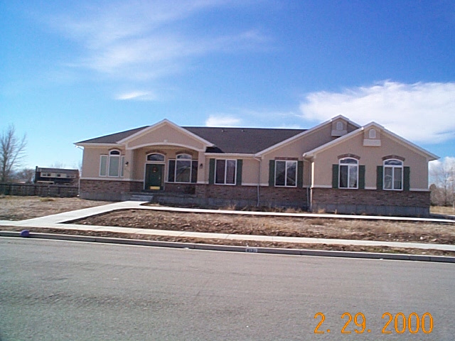
Total Photos: 1
|
| |
|
|
| Property Address: |
|
| Mailing Address: 318 N PALISADES DR OREM, UT 84097-5091 |
|
| Acreage: 0 |
|
| Last Document:
52573-1994
|
|
| Subdivision Map Filing |
|
| Legal Description:
LOT 26, PLAT B, MOUNTAIN VIEW ACRES SUBDV. AREA 0.976 AC. |
|
- Owner Names
- Value History
- Tax History
- Location
- Photos
- Documents
- Aerial Image
| |
----- Real Estate Values ----- |
---Improvements--- |
---Greenbelt--- |
Total |
| Year |
Com |
Res |
Agr |
Tot |
Com |
Res |
Agr |
Tot |
Land |
Homesite |
Tot |
Market Value |
| 1998 |
$0 |
$55,746 |
$0 |
$55,746 |
$0 |
$0 |
$0 |
$0 |
$0 |
$0 |
$0 |
$55,746 |
| 1997 |
$0 |
$55,746 |
$0 |
$55,746 |
$0 |
$0 |
$0 |
$0 |
$0 |
$0 |
$0 |
$55,746 |
| 1996 |
$0 |
$54,890 |
$0 |
$54,890 |
$0 |
$0 |
$0 |
$0 |
$0 |
$0 |
$0 |
$54,890 |
| 1995 |
$0 |
$49,900 |
$0 |
$49,900 |
$0 |
$0 |
$0 |
$0 |
$0 |
$0 |
$0 |
$49,900 |
| Year |
General Taxes |
Adjustments |
Net Taxes |
Fees |
Payments |
Tax Balance* |
Balance Due |
Tax Area |
| 1998 |
$555.51 |
$0.00 |
$555.51 |
$0.00 |
|
$0.00
|
$0.00 |
045 - HIGHLAND CITY |
| 1997 |
$552.72 |
$0.00 |
$552.72 |
$0.00 |
|
$0.00
|
$0.00 |
045 - HIGHLAND CITY |
| 1996 |
$511.79 |
$0.00 |
$511.79 |
$0.00 |
|
$0.00
|
$0.00 |
045 - HIGHLAND CITY |
| 1995 |
$524.40 |
$0.00 |
$524.40 |
$0.00 |
|
$0.00
|
$0.00 |
045 - HIGHLAND CITY |
|
*The visual representation is a sum of taxes for the year(s) selected and is for reference only and no liability is assumed for any inaccuracies, incorrect data or variations.
|
|
* Note: Original tax amount (Does not include applicable interest and/or fees).
| Entry # |
Date |
Recorded |
Type |
Party1 (Grantor) |
Party2 (Grantee) |
| 91152-1998 |
09/01/1998 |
09/09/1998 |
WD |
T & R CORPORATION |
NORINE, PAUL & MICHELLE |
| 46273-1996 |
05/28/1996 |
06/04/1996 |
RESOL |
UTAH COUNTY |
WHOM OF INTEREST |
| 43831-1996 |
05/06/1996 |
05/24/1996 |
REC |
BANK OF AMERICAN FORK TEE |
THOMAS, REX L & MARY R TEE |
| 61857-1994 |
08/01/1994 |
08/02/1994 |
PRO COV |
T & R CORPORATION (ET AL) |
WHOM OF INTEREST |
| 52573-1994 |
06/21/1994 |
06/24/1994 |
QCD |
THOMAS, REX L & MARY R TEE (ET AL) |
T & R CORPORATION |
| 45569-1994 |
05/24/1994 |
06/01/1994 |
S PLAT |
THOMAS, RAY L TEE (ET AL) |
MOUNTAIN VIEW ACRES PLAT B |
Main Menu Comments or Concerns on Value/Appraisal - Assessor's Office
Documents/Owner/Parcel information - Recorder's Office
Address Change for Tax Notice
This page was created on 12/9/2025 1:21:14 PM |
