Property Information
| Serial Number: 38:510:0001 |
Serial Life: 2017... |
|
|
 Total Photos: 6
|
| |
|
|
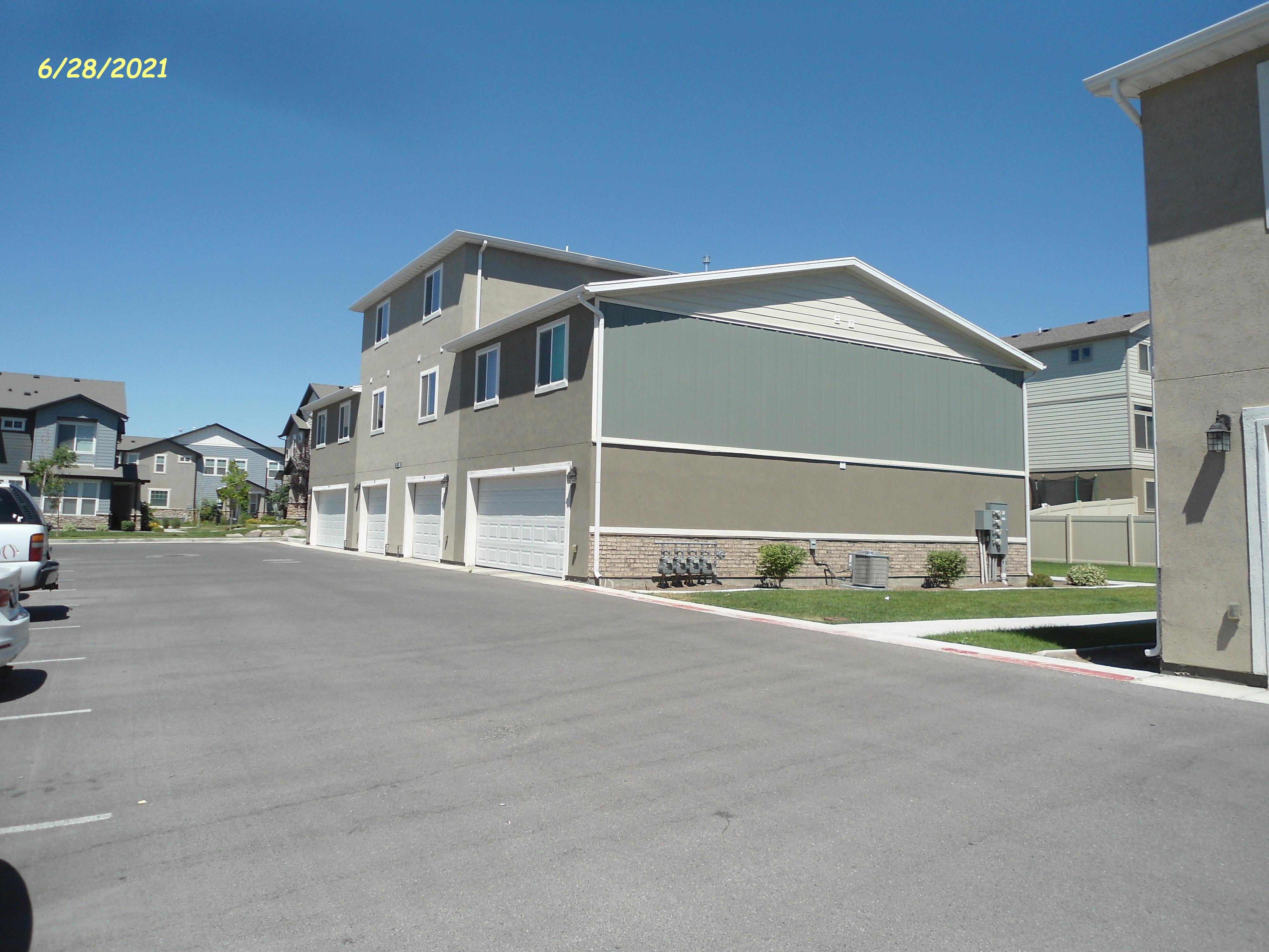
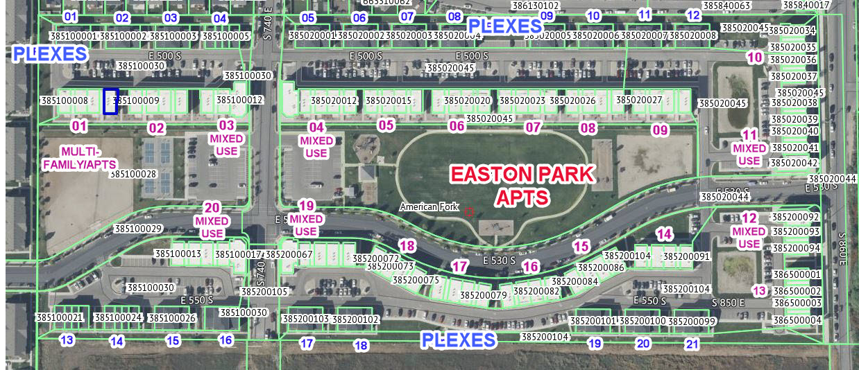
| Property Address: 667 E 500 SOUTH - AMERICAN FORK |
|
| Mailing Address: 5338 ASPEN HOLLOW RD KAMAS, UT 84036 |
|
| Acreage: 0.086879 |
|
| Last Document:
123246-2016
|
|
| Subdivision Map Filing |
|
| Taxing Description:
LOT 43, EASTON PARK, PHASE 2 SUB AREA 0.087 AC.
*Taxing description NOT FOR LEGAL DOCUMENTS
|
|
- Owner Names
- Value History
- Tax History
- Location
- Photos
- Documents
- Aerial Image
| |
----- Real Estate Values ----- |
---Improvements--- |
---Greenbelt--- |
Total |
| Year |
Com |
Res |
Agr |
Tot |
Com |
Res |
Agr |
Tot |
Land |
Homesite |
Tot |
Market Value |
| 2025 |
$0 |
$354,800 |
$0 |
$354,800 |
$0 |
$827,800 |
$0 |
$827,800 |
$0 |
$0 |
$0 |
$1,182,600 |
| 2024 |
$0 |
$279,100 |
$0 |
$279,100 |
$0 |
$837,100 |
$0 |
$837,100 |
$0 |
$0 |
$0 |
$1,116,200 |
| 2023 |
$0 |
$276,300 |
$0 |
$276,300 |
$0 |
$828,800 |
$0 |
$828,800 |
$0 |
$0 |
$0 |
$1,105,100 |
| 2022 |
$0 |
$254,500 |
$0 |
$254,500 |
$0 |
$764,000 |
$0 |
$764,000 |
$0 |
$0 |
$0 |
$1,018,500 |
| 2021 |
$0 |
$195,800 |
$0 |
$195,800 |
$0 |
$587,700 |
$0 |
$587,700 |
$0 |
$0 |
$0 |
$783,500 |
| 2020 |
$0 |
$182,200 |
$0 |
$182,200 |
$0 |
$546,700 |
$0 |
$546,700 |
$0 |
$0 |
$0 |
$728,900 |
| 2019 |
$0 |
$169,500 |
$0 |
$169,500 |
$0 |
$508,600 |
$0 |
$508,600 |
$0 |
$0 |
$0 |
$678,100 |
| 2018 |
$0 |
$119,200 |
$0 |
$119,200 |
$0 |
$476,900 |
$0 |
$476,900 |
$0 |
$0 |
$0 |
$596,100 |
| 2017 |
$0 |
$115,000 |
$0 |
$115,000 |
$0 |
$0 |
$0 |
$0 |
$0 |
$0 |
$0 |
$115,000 |
| Year |
General Taxes |
Adjustments |
Net Taxes |
Fees |
Payments |
Tax Balance* |
Balance Due |
Tax Area |
| 2026 |
$0.00 |
$0.00 |
$0.00 |
$0.00 |
|
$0.00
|
$0.00 |
060 - AMERICAN FORK CITY |
| 2025 |
$5,682.16 |
$0.00 |
$5,682.16 |
$0.00 |
|
|
Click for Payoff
|
060 - AMERICAN FORK CITY |
| 2024 |
$5,525.19 |
$0.00 |
$5,525.19 |
$0.00 |
|
$0.00
|
$0.00 |
060 - AMERICAN FORK CITY |
| 2023 |
$5,159.66 |
$0.00 |
$5,159.66 |
$0.00 |
|
$0.00
|
$0.00 |
060 - AMERICAN FORK CITY |
| 2022 |
$4,818.63 |
$0.00 |
$4,818.63 |
$0.00 |
|
$0.00
|
$0.00 |
060 - AMERICAN FORK CITY |
| 2021 |
$4,314.85 |
$0.00 |
$4,314.85 |
$0.00 |
|
$0.00
|
$0.00 |
060 - AMERICAN FORK CITY |
| 2020 |
$4,138.84 |
$0.00 |
$4,138.84 |
$0.00 |
|
$0.00
|
$0.00 |
060 - AMERICAN FORK CITY |
| 2019 |
$3,722.84 |
$0.00 |
$3,722.84 |
$0.00 |
|
$0.00
|
$0.00 |
060 - AMERICAN FORK CITY |
| 2018 |
$3,422.81 |
$0.00 |
$3,422.81 |
$0.00 |
|
$0.00
|
$0.00 |
060 - AMERICAN FORK CITY |
| 2017 |
$1,223.49 |
$0.00 |
$1,223.49 |
$0.00 |
|
$0.00
|
$0.00 |
060 - AMERICAN FORK CITY |
* Note: Original tax amount (Does not include applicable interest and/or fees).
| Entry # |
Date |
Recorded |
Type |
Party1 (Grantor) |
Party2 (Grantee) |
| 51410-2018 |
05/31/2018 |
06/01/2018 |
ADECCOV |
VERTICAL DEVELOPMENT LLC |
WHOM OF INTEREST |
| 4809-2018 |
01/08/2018 |
01/16/2018 |
REC |
VANCE, DWAYNE A TEE |
VERTICAL DEVELOPMENT LLC |
| 73200-2017 |
07/31/2017 |
07/31/2017 |
ADECCOV |
VERTICAL DEVELOPMENT LLC |
WHOM OF INTEREST |
| 30282-2017 |
03/23/2017 |
03/29/2017 |
REC |
VANCE, DWAYNE A TEE |
VERTICAL DEVELOPMENT LLC |
| 8265-2017 |
01/12/2017 |
01/26/2017 |
AF |
AUTREY, ROBERT D (ET AL) |
WHOM OF INTEREST |
| 130788-2016 |
12/28/2016 |
12/28/2016 |
AFF SUR |
DIAMOND LAND SURVEYING LLC |
WHOM OF INTEREST |
| 129884-2016 |
12/14/2016 |
12/23/2016 |
REC |
VANCE, DWAYNE A ATY |
VERTICAL DEVELOPMENT LLC |
| 125611-2016 |
11/09/2016 |
12/14/2016 |
AGR |
VERTICAL DEVELOPMENT LLC |
AMERICAN FORK CITY |
| 124374-2016 |
11/10/2016 |
12/09/2016 |
SCRIVAF |
UNITED WEST TITLE INSURANCE AGENCY INC |
WHOM OF INTEREST |
| 123246-2016 |
12/05/2016 |
12/07/2016 |
WD |
VERTICAL DEVELOPMENT LLC |
LOVEDAY, LANCE |
| 113692-2016 |
05/10/2016 |
11/10/2016 |
S PLAT |
TRANSITIONAL FUNDING PARTNERS LP (ET AL) |
EASTON PARK PHASE 2 |
Main Menu Comments or Concerns on Value/Appraisal - Assessor's Office
Documents/Owner/Parcel information - Recorder's Office
Address Change for Tax Notice
This page was created on 12/10/2025 6:39:32 PM |