Property Information
mobile view
| Serial Number: 55:541:0011 |
Serial Life: 2003... |
|
|

Total Photos: 4
|
| |
|
|
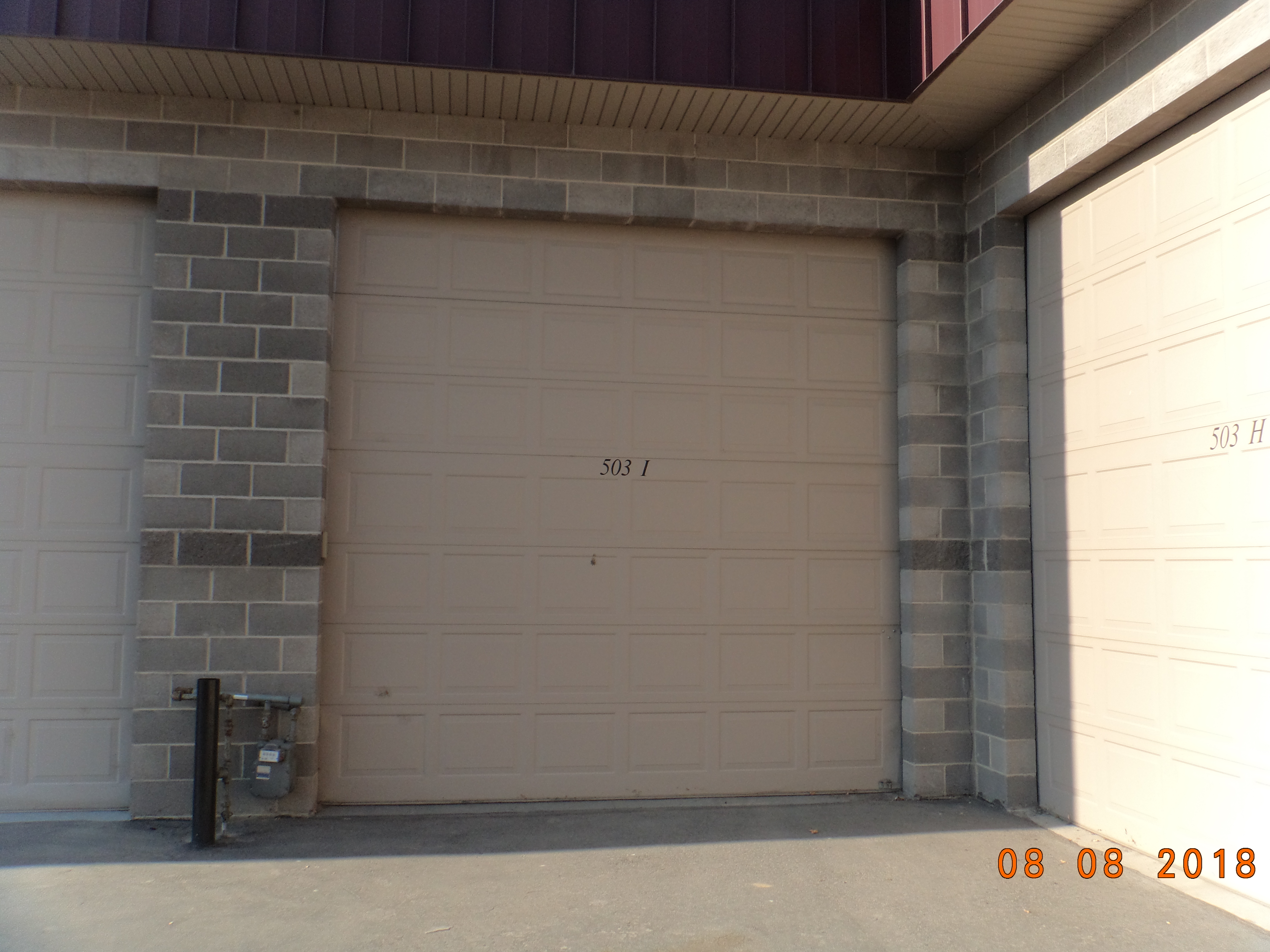
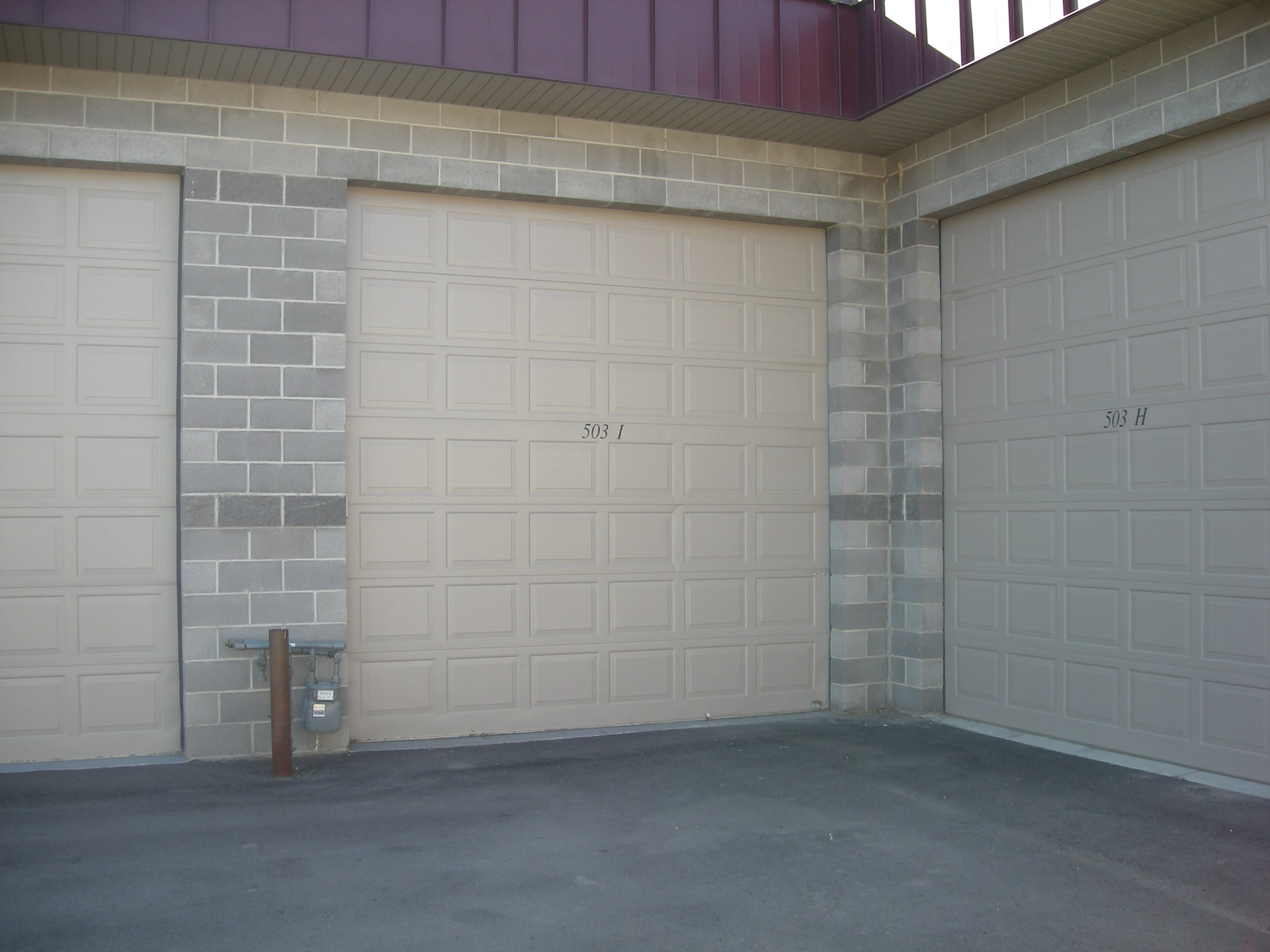
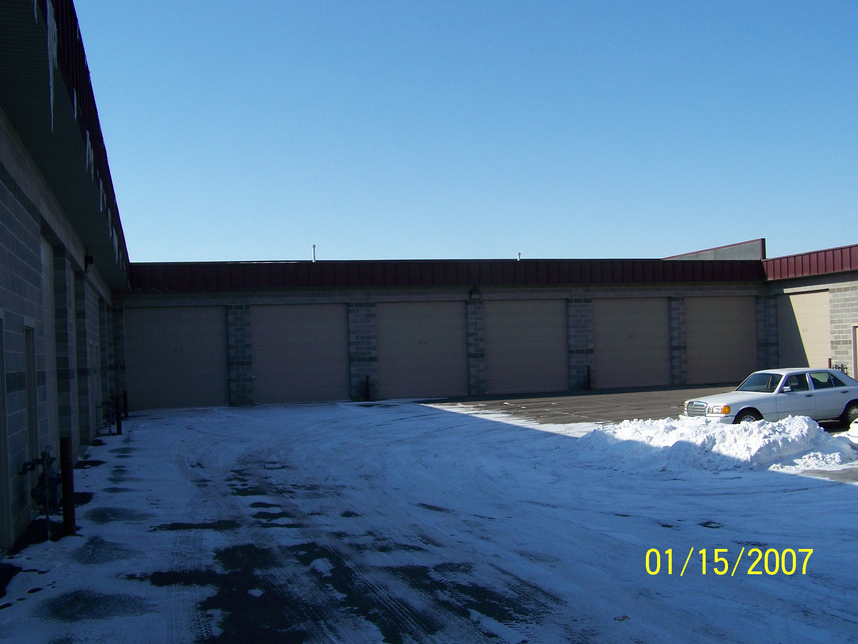
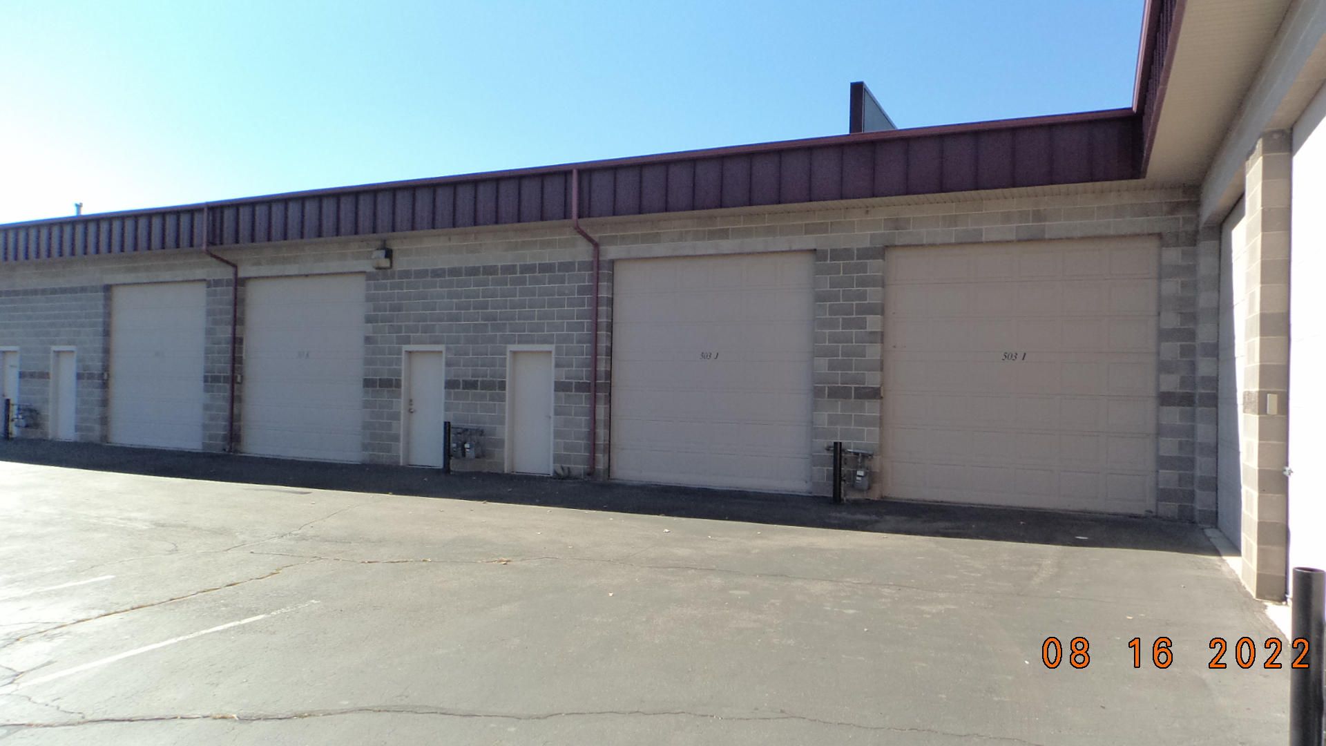
| Property Address: 503 N 1500 WEST Unit#I - OREM |
|
| Mailing Address: 150 S 1320 E LINDON, UT 84042-2178 |
|
| Acreage: 0.036 |
|
| Last Document:
102736-2002
|
|
| Subdivision Map Filing |
|
| Taxing Description:
LOT 11, WASHBURN STORAGE PUD SUBDV. AREA 0.036 AC.
*Taxing description NOT FOR LEGAL DOCUMENTS
|
|
- Owner Names
- Value History
- Tax History
- Location
- Photos
- Documents
- Aerial Image
| |
----- Real Estate Values ----- |
---Improvements--- |
---Greenbelt--- |
Total |
| Year |
Com |
Res |
Agr |
Tot |
Com |
Res |
Agr |
Tot |
Land |
Homesite |
Tot |
Market Value |
| 2024 |
$28,600 |
$0 |
$0 |
$28,600 |
$132,400 |
$0 |
$0 |
$132,400 |
$0 |
$0 |
$0 |
$161,000 |
| 2023 |
$28,000 |
$0 |
$0 |
$28,000 |
$130,400 |
$0 |
$0 |
$130,400 |
$0 |
$0 |
$0 |
$158,400 |
| 2022 |
$28,600 |
$0 |
$0 |
$28,600 |
$100,100 |
$0 |
$0 |
$100,100 |
$0 |
$0 |
$0 |
$128,700 |
| 2021 |
$28,600 |
$0 |
$0 |
$28,600 |
$100,100 |
$0 |
$0 |
$100,100 |
$0 |
$0 |
$0 |
$128,700 |
| 2020 |
$28,600 |
$0 |
$0 |
$28,600 |
$100,100 |
$0 |
$0 |
$100,100 |
$0 |
$0 |
$0 |
$128,700 |
| 2019 |
$25,300 |
$0 |
$0 |
$25,300 |
$116,900 |
$0 |
$0 |
$116,900 |
$0 |
$0 |
$0 |
$142,200 |
| 2018 |
$20,200 |
$0 |
$0 |
$20,200 |
$120,400 |
$0 |
$0 |
$120,400 |
$0 |
$0 |
$0 |
$140,600 |
| 2017 |
$20,200 |
$0 |
$0 |
$20,200 |
$120,400 |
$0 |
$0 |
$120,400 |
$0 |
$0 |
$0 |
$140,600 |
| 2016 |
$20,200 |
$0 |
$0 |
$20,200 |
$120,400 |
$0 |
$0 |
$120,400 |
$0 |
$0 |
$0 |
$140,600 |
| 2015 |
$20,200 |
$0 |
$0 |
$20,200 |
$73,600 |
$0 |
$0 |
$73,600 |
$0 |
$0 |
$0 |
$93,800 |
| 2014 |
$20,200 |
$0 |
$0 |
$20,200 |
$73,600 |
$0 |
$0 |
$73,600 |
$0 |
$0 |
$0 |
$93,800 |
| 2013 |
$20,200 |
$0 |
$0 |
$20,200 |
$73,600 |
$0 |
$0 |
$73,600 |
$0 |
$0 |
$0 |
$93,800 |
| 2012 |
$20,200 |
$0 |
$0 |
$20,200 |
$73,600 |
$0 |
$0 |
$73,600 |
$0 |
$0 |
$0 |
$93,800 |
| 2011 |
$23,200 |
$0 |
$0 |
$23,200 |
$69,700 |
$0 |
$0 |
$69,700 |
$0 |
$0 |
$0 |
$92,900 |
| 2010 |
$25,186 |
$0 |
$0 |
$25,186 |
$73,377 |
$0 |
$0 |
$73,377 |
$0 |
$0 |
$0 |
$98,563 |
| 2009 |
$25,700 |
$0 |
$0 |
$25,700 |
$78,900 |
$0 |
$0 |
$78,900 |
$0 |
$0 |
$0 |
$104,600 |
| 2008 |
$33,500 |
$0 |
$0 |
$33,500 |
$80,700 |
$0 |
$0 |
$80,700 |
$0 |
$0 |
$0 |
$114,200 |
| 2007 |
$31,900 |
$0 |
$0 |
$31,900 |
$76,900 |
$0 |
$0 |
$76,900 |
$0 |
$0 |
$0 |
$108,800 |
| 2006 |
$12,000 |
$0 |
$0 |
$12,000 |
$82,000 |
$0 |
$0 |
$82,000 |
$0 |
$0 |
$0 |
$94,000 |
| 2005 |
$12,000 |
$0 |
$0 |
$12,000 |
$82,000 |
$0 |
$0 |
$82,000 |
$0 |
$0 |
$0 |
$94,000 |
| 2004 |
$12,000 |
$0 |
$0 |
$12,000 |
$82,000 |
$0 |
$0 |
$82,000 |
$0 |
$0 |
$0 |
$94,000 |
| 2003 |
$9,000 |
$0 |
$0 |
$9,000 |
$29,300 |
$0 |
$0 |
$29,300 |
$0 |
$0 |
$0 |
$38,300 |
| Year |
General Taxes |
Adjustments |
Net Taxes |
Fees |
Payments |
Tax Balance* |
Balance Due |
Tax District |
| 2025 |
$0.00 |
$0.00 |
$0.00 |
$0.00 |
|
$0.00
|
$0.00 |
090 - OREM CITY |
| 2024 |
$0.00 |
$0.00 |
$0.00 |
$0.00 |
|
$0.00
|
$0.00 |
090 - OREM CITY |
| 2023 |
$1,205.27 |
$0.00 |
$1,205.27 |
$0.00 |
|
$0.00
|
$0.00 |
090 - OREM CITY |
| 2022 |
$1,010.81 |
$0.00 |
$1,010.81 |
$0.00 |
|
$0.00
|
$0.00 |
090 - OREM CITY |
| 2021 |
$1,213.38 |
$0.00 |
$1,213.38 |
$0.00 |
|
$0.00
|
$0.00 |
090 - OREM CITY |
| 2020 |
$1,234.62 |
$0.00 |
$1,234.62 |
$0.00 |
|
$0.00
|
$0.00 |
090 - OREM CITY |
| 2019 |
$1,311.80 |
$0.00 |
$1,311.80 |
$0.00 |
|
$0.00
|
$0.00 |
090 - OREM CITY |
| 2018 |
$1,357.49 |
$0.00 |
$1,357.49 |
$0.00 |
|
$0.00
|
$0.00 |
090 - OREM CITY |
| 2017 |
$1,393.77 |
$0.00 |
$1,393.77 |
$0.00 |
|
$0.00
|
$0.00 |
090 - OREM CITY |
| 2016 |
$1,511.45 |
$0.00 |
$1,511.45 |
$0.00 |
|
$0.00
|
$0.00 |
090 - OREM CITY |
| 2015 |
$1,066.22 |
$0.00 |
$1,066.22 |
$0.00 |
|
$0.00
|
$0.00 |
090 - OREM CITY |
| 2014 |
$1,071.10 |
$0.00 |
$1,071.10 |
$0.00 |
|
$0.00
|
$0.00 |
090 - OREM CITY |
| 2013 |
$1,155.05 |
$0.00 |
$1,155.05 |
$0.00 |
|
$0.00
|
$0.00 |
090 - OREM CITY |
| 2012 |
$1,178.88 |
$0.00 |
$1,178.88 |
$0.00 |
|
$0.00
|
$0.00 |
090 - OREM CITY |
| 2011 |
$1,161.99 |
$0.00 |
$1,161.99 |
$0.00 |
|
$0.00
|
$0.00 |
090 - OREM CITY |
| 2010 |
$1,154.17 |
$0.00 |
$1,154.17 |
$0.00 |
|
$0.00
|
$0.00 |
090 - OREM CITY |
| 2009 |
$1,135.43 |
$0.00 |
$1,135.43 |
$0.00 |
|
$0.00
|
$0.00 |
090 - OREM CITY |
| 2008 |
$1,148.74 |
$0.00 |
$1,148.74 |
$0.00 |
|
$0.00
|
$0.00 |
090 - OREM CITY |
| 2007 |
$1,081.91 |
$0.00 |
$1,081.91 |
$0.00 |
|
$0.00
|
$0.00 |
090 - OREM CITY |
| 2006 |
$995.37 |
$0.00 |
$995.37 |
$0.00 |
|
$0.00
|
$0.00 |
090 - OREM CITY |
| 2005 |
$1,123.49 |
$0.00 |
$1,123.49 |
$0.00 |
|
$0.00
|
$0.00 |
090 - OREM CITY |
| 2004 |
$1,103.56 |
$0.00 |
$1,103.56 |
$0.00 |
|
$0.00
|
$0.00 |
090 - OREM CITY |
| 2003 |
$436.31 |
$0.00 |
$436.31 |
$0.00 |
|
$0.00
|
$0.00 |
090 - OREM CITY |
* Note: Original tax amount (Does not include applicable interest and/or fees).
| Entry # |
Date |
Recorded |
Type |
Party1 (Grantor) |
Party2 (Grantee) |
| 55644-2023 |
07/18/2023 |
08/24/2023 |
REC |
CENTRAL BANK TEE |
GREENWOOD, MARK S |
| 63627-2020 |
05/05/2020 |
05/12/2020 |
REC |
CENTRAL BANK TEE |
GREENWOOD, MARK S |
| 40188-2018 |
04/30/2018 |
04/30/2018 |
D TR |
GREENWOOD, MARK S |
CENTRAL BANK |
| 37316-2010 |
05/04/2010 |
05/06/2010 |
REC |
CENTRAL BANK TEE |
JDP STORAGE LC |
| 27847-2005 |
03/16/2005 |
03/16/2005 |
D TR |
GREENWOOD, MARK S |
CENTRAL BANK |
| 27846-2005 |
03/15/2005 |
03/16/2005 |
WD |
SPANISH RIDGE LC |
GREENWOOD, MARK S |
| 68229-2004 |
05/21/2004 |
06/15/2004 |
P REC |
CENTRAL BANK TEE |
JDP STORAGE LC |
| 68228-2004 |
05/21/2004 |
06/15/2004 |
P REC |
CENTRAL BANK TEE |
JDP STORAGE LC |
| 47904-2004 |
04/26/2004 |
04/27/2004 |
WD |
JDP STORAGE LC |
SPANISH RIDGE LC |
| 52647-2003 |
03/25/2003 |
04/07/2003 |
REC |
WESTERN COMMUNITY BANK TEE |
TENT PEG LC |
| 52646-2003 |
04/02/2003 |
04/07/2003 |
REC |
BANK OF AMERICAN FORK TEE |
CARTER CONSTRUCTION COMPANY |
| 52645-2003 |
04/02/2003 |
04/07/2003 |
REC |
BANK OF AMERICAN FORK TEE |
CARTER CONSTRUCTION COMPANY |
| 103647-2002 |
09/05/2002 |
09/06/2002 |
DECLCOV |
JDP STORAGE LC |
WHOM OF INTEREST |
| 102736-2002 |
08/13/2002 |
09/04/2002 |
P PLAT |
J D P STORAGE LC |
WASHBURN STORAGE PUD |
Main Menu Comments or Concerns on Value/Appraisal - Assessor's Office
Documents/Owner/Parcel information - Recorder's Office
Address Change for Tax Notice
This page was created on 5/17/2024 4:43:09 AM |