Property Information
mobile view
| Serial Number: 43:130:0003 |
Serial Life: 2004... |
|
|
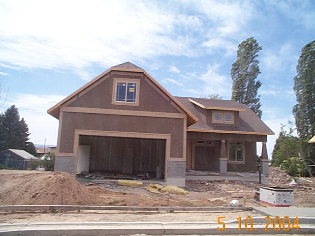
Total Photos: 1
|
| |
|
|
| Property Address: 1235 N 280 WEST - OREM |
|
| Mailing Address: 1235 N 280 W OREM, UT 84057-2618 |
|
| Acreage: 0.243 |
|
| Last Document:
180873-2003
|
|
| Subdivision Map Filing |
|
| Taxing Description:
LOT 3, PLAT A, JOHNSONS ACRE SUBDV. AREA 0.243 AC.
*Taxing description NOT FOR LEGAL DOCUMENTS
|
|
- Owner Names
- Value History
- Tax History
- Location
- Photos
- Documents
- Aerial Image
| |
----- Real Estate Values ----- |
---Improvements--- |
---Greenbelt--- |
Total |
| Year |
Com |
Res |
Agr |
Tot |
Com |
Res |
Agr |
Tot |
Land |
Homesite |
Tot |
Market Value |
| 2023 |
$0 |
$255,600 |
$0 |
$255,600 |
$0 |
$294,400 |
$0 |
$294,400 |
$0 |
$0 |
$0 |
$550,000 |
| 2022 |
$0 |
$272,500 |
$0 |
$272,500 |
$0 |
$275,200 |
$0 |
$275,200 |
$0 |
$0 |
$0 |
$547,700 |
| 2021 |
$0 |
$160,300 |
$0 |
$160,300 |
$0 |
$245,700 |
$0 |
$245,700 |
$0 |
$0 |
$0 |
$406,000 |
| 2020 |
$0 |
$128,200 |
$0 |
$128,200 |
$0 |
$240,900 |
$0 |
$240,900 |
$0 |
$0 |
$0 |
$369,100 |
| 2019 |
$0 |
$128,200 |
$0 |
$128,200 |
$0 |
$209,500 |
$0 |
$209,500 |
$0 |
$0 |
$0 |
$337,700 |
| 2018 |
$0 |
$120,900 |
$0 |
$120,900 |
$0 |
$209,500 |
$0 |
$209,500 |
$0 |
$0 |
$0 |
$330,400 |
| 2017 |
$0 |
$84,200 |
$0 |
$84,200 |
$0 |
$209,500 |
$0 |
$209,500 |
$0 |
$0 |
$0 |
$293,700 |
| 2016 |
$0 |
$75,500 |
$0 |
$75,500 |
$0 |
$182,200 |
$0 |
$182,200 |
$0 |
$0 |
$0 |
$257,700 |
| 2015 |
$0 |
$73,300 |
$0 |
$73,300 |
$0 |
$167,600 |
$0 |
$167,600 |
$0 |
$0 |
$0 |
$240,900 |
| 2014 |
$0 |
$71,100 |
$0 |
$71,100 |
$0 |
$165,100 |
$0 |
$165,100 |
$0 |
$0 |
$0 |
$236,200 |
| 2013 |
$0 |
$57,600 |
$0 |
$57,600 |
$0 |
$165,100 |
$0 |
$165,100 |
$0 |
$0 |
$0 |
$222,700 |
| 2012 |
$0 |
$58,900 |
$0 |
$58,900 |
$0 |
$162,100 |
$0 |
$162,100 |
$0 |
$0 |
$0 |
$221,000 |
| 2011 |
$0 |
$70,700 |
$0 |
$70,700 |
$0 |
$157,100 |
$0 |
$157,100 |
$0 |
$0 |
$0 |
$227,800 |
| 2010 |
$0 |
$83,307 |
$0 |
$83,307 |
$0 |
$158,847 |
$0 |
$158,847 |
$0 |
$0 |
$0 |
$242,154 |
| 2009 |
$0 |
$94,100 |
$0 |
$94,100 |
$0 |
$150,500 |
$0 |
$150,500 |
$0 |
$0 |
$0 |
$244,600 |
| 2008 |
$0 |
$94,100 |
$0 |
$94,100 |
$0 |
$204,200 |
$0 |
$204,200 |
$0 |
$0 |
$0 |
$298,300 |
| 2007 |
$0 |
$98,000 |
$0 |
$98,000 |
$0 |
$219,300 |
$0 |
$219,300 |
$0 |
$0 |
$0 |
$317,300 |
| 2006 |
$0 |
$51,500 |
$0 |
$51,500 |
$0 |
$113,400 |
$0 |
$113,400 |
$0 |
$0 |
$0 |
$164,900 |
| 2005 |
$0 |
$49,000 |
$0 |
$49,000 |
$0 |
$100,322 |
$0 |
$100,322 |
$0 |
$0 |
$0 |
$149,322 |
| 2004 |
$0 |
$49,000 |
$0 |
$49,000 |
$0 |
$0 |
$0 |
$0 |
$0 |
$0 |
$0 |
$49,000 |
| Year |
General Taxes |
Adjustments |
Net Taxes |
Fees |
Payments |
Tax Balance* |
Balance Due |
Tax District |
| 2024 |
$0.00 |
$0.00 |
$0.00 |
$0.00 |
|
$0.00
|
$0.00 |
090 - OREM CITY |
| 2023 |
$2,301.72 |
$0.00 |
$2,301.72 |
$0.00 |
|
$0.00
|
$0.00 |
090 - OREM CITY |
| 2022 |
$2,365.90 |
$0.00 |
$2,365.90 |
$0.00 |
|
$0.00
|
$0.00 |
090 - OREM CITY |
| 2021 |
$2,105.27 |
$0.00 |
$2,105.27 |
$0.00 |
|
$0.00
|
$0.00 |
090 - OREM CITY |
| 2020 |
$1,947.43 |
$0.00 |
$1,947.43 |
$0.00 |
|
$0.00
|
$0.00 |
090 - OREM CITY |
| 2019 |
$1,713.41 |
$0.00 |
$1,713.41 |
$0.00 |
|
$0.00
|
$0.00 |
090 - OREM CITY |
| 2018 |
$1,754.51 |
$0.00 |
$1,754.51 |
$0.00 |
|
$0.00
|
$0.00 |
090 - OREM CITY |
| 2017 |
$1,601.30 |
$0.00 |
$1,601.30 |
$0.00 |
|
$0.00
|
$0.00 |
090 - OREM CITY |
| 2016 |
$1,523.65 |
$0.00 |
$1,523.65 |
$0.00 |
|
$0.00
|
$0.00 |
090 - OREM CITY |
| 2015 |
$1,506.07 |
$0.00 |
$1,506.07 |
$0.00 |
|
$0.00
|
$0.00 |
090 - OREM CITY |
| 2014 |
$1,483.44 |
$0.00 |
$1,483.44 |
$0.00 |
|
$0.00
|
$0.00 |
090 - OREM CITY |
| 2013 |
$1,508.28 |
$0.00 |
$1,508.28 |
$0.00 |
|
$0.00
|
$0.00 |
090 - OREM CITY |
| 2012 |
$1,527.64 |
$0.00 |
$1,527.64 |
$0.00 |
|
$0.00
|
$0.00 |
090 - OREM CITY |
| 2011 |
$1,567.13 |
$0.00 |
$1,567.13 |
$0.00 |
|
$0.00
|
$0.00 |
090 - OREM CITY |
| 2010 |
$1,559.60 |
$0.00 |
$1,559.60 |
$0.00 |
|
$0.00
|
$0.00 |
090 - OREM CITY |
| 2009 |
$1,460.32 |
$0.00 |
$1,460.32 |
$0.00 |
|
$0.00
|
$0.00 |
090 - OREM CITY |
| 2008 |
$1,650.33 |
$0.00 |
$1,650.33 |
$0.00 |
|
$0.00
|
$0.00 |
090 - OREM CITY |
| 2007 |
$1,735.38 |
($36.06) |
$1,699.32 |
$0.00 |
|
$0.00
|
$0.00 |
090 - OREM CITY |
| 2006 |
$960.37 |
$0.00 |
$960.37 |
$0.00 |
|
$0.00
|
$0.00 |
090 - OREM CITY |
| 2005 |
$981.58 |
$0.00 |
$981.58 |
$0.00 |
|
$0.00
|
$0.00 |
090 - OREM CITY |
| 2004 |
$575.26 |
$0.00 |
$575.26 |
$0.00 |
|
$0.00
|
$0.00 |
090 - OREM CITY |
* Note: Original tax amount (Does not include applicable interest and/or fees).
| Entry # |
Date |
Recorded |
Type |
Party1 (Grantor) |
Party2 (Grantee) |
| 90734-2006 |
07/18/2006 |
07/18/2006 |
P REC |
BARTLETT TITLE INSURANCE AGENCY |
CARTER, DENNIS B |
| 137961-2005 |
11/29/2005 |
11/30/2005 |
WD |
CARTER, DENNIS B |
SMITH, MICHAEL JAY & EMILY |
| 82033-2005 |
07/26/2005 |
07/28/2005 |
WD |
SMITH, MICHAEL JAY & EMILY P |
SMITH, MICHAEL JAY & EMILY P TEE |
| 15116-2005 |
01/11/2005 |
02/14/2005 |
WD |
CARTER CONSTRUCTION COMPANY |
SMITH, MICHAEL JAY & EMILY |
| 197762-2003 |
12/10/2003 |
12/18/2003 |
EAS |
CARTER, DENNIS B |
QUESTAR GAS COMPANY |
| 180873-2003 |
10/27/2003 |
11/14/2003 |
S PLAT |
FAIRBANKS, WILLIAM M (ET AL) |
JOHNSON'S ACRE PLAT A |
Main Menu Comments or Concerns on Value/Appraisal - Assessor's Office
Documents/Owner/Parcel information - Recorder's Office
Address Change for Tax Notice
This page was created on 4/29/2024 6:04:51 AM |