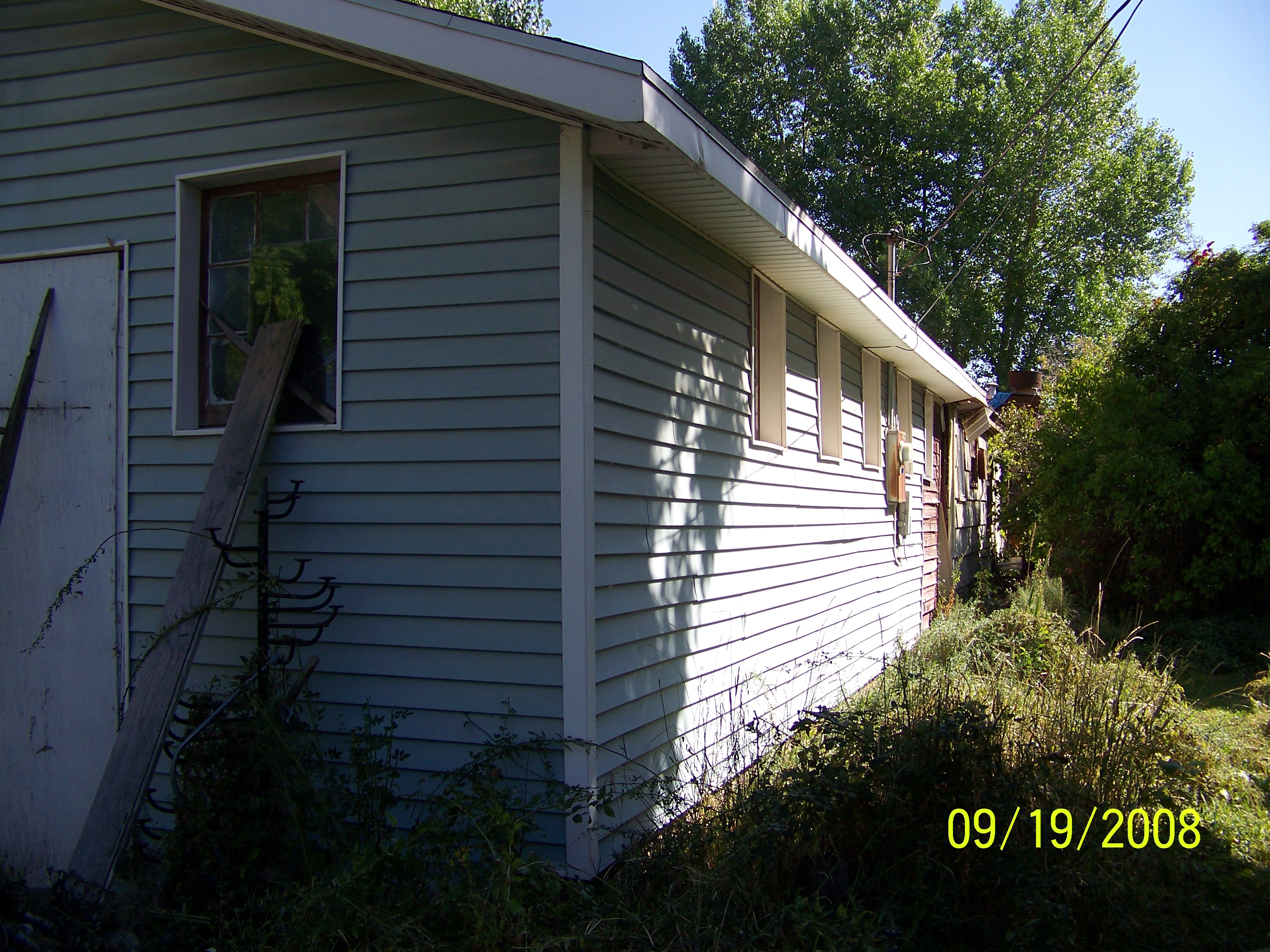
Property Information
mobile view
| Serial Number: 36:966:0003 |
Serial Life: 2003... |
|
|
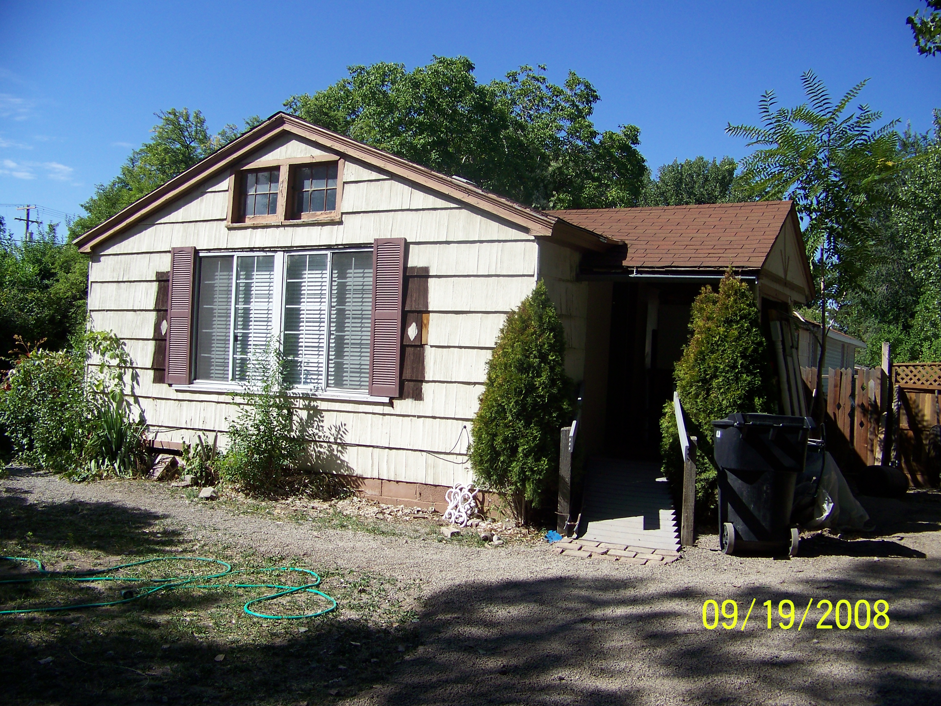
Total Photos: 2
|
| |
|
|
| Property Address: 235 N 100 EAST - PAYSON |
|
| Mailing Address: 209 N 100 E PAYSON, UT 84651-1803 |
|
| Acreage: 0.296 |
|
| Last Document:
69046-2002
|
|
| Subdivision Map Filing |
|
| Taxing Description:
LOT 3, PLAT A, CLASSIC ONE SUBDV. AREA 0.296 AC.
*Taxing description NOT FOR LEGAL DOCUMENTS
|
|
- Owner Names
- Value History
- Tax History
- Location
- Photos
- Documents
- Aerial Image
| |
----- Real Estate Values ----- |
---Improvements--- |
---Greenbelt--- |
Total |
| Year |
Com |
Res |
Agr |
Tot |
Com |
Res |
Agr |
Tot |
Land |
Homesite |
Tot |
Market Value |
| 2024 |
$0 |
$115,500 |
$0 |
$115,500 |
$0 |
$116,300 |
$0 |
$116,300 |
$0 |
$0 |
$0 |
$231,800 |
| 2023 |
$0 |
$115,500 |
$0 |
$115,500 |
$0 |
$109,400 |
$0 |
$109,400 |
$0 |
$0 |
$0 |
$224,900 |
| 2022 |
$0 |
$123,200 |
$0 |
$123,200 |
$0 |
$91,400 |
$0 |
$91,400 |
$0 |
$0 |
$0 |
$214,600 |
| 2021 |
$0 |
$88,000 |
$0 |
$88,000 |
$0 |
$70,300 |
$0 |
$70,300 |
$0 |
$0 |
$0 |
$158,300 |
| 2020 |
$0 |
$76,500 |
$0 |
$76,500 |
$0 |
$65,200 |
$0 |
$65,200 |
$0 |
$0 |
$0 |
$141,700 |
| 2019 |
$0 |
$68,900 |
$0 |
$68,900 |
$0 |
$56,700 |
$0 |
$56,700 |
$0 |
$0 |
$0 |
$125,600 |
| 2018 |
$0 |
$58,100 |
$0 |
$58,100 |
$0 |
$49,300 |
$0 |
$49,300 |
$0 |
$0 |
$0 |
$107,400 |
| 2017 |
$0 |
$55,100 |
$0 |
$55,100 |
$0 |
$42,900 |
$0 |
$42,900 |
$0 |
$0 |
$0 |
$98,000 |
| 2016 |
$0 |
$49,700 |
$0 |
$49,700 |
$0 |
$30,000 |
$0 |
$30,000 |
$0 |
$0 |
$0 |
$79,700 |
| 2015 |
$0 |
$45,900 |
$0 |
$45,900 |
$0 |
$10,200 |
$0 |
$10,200 |
$0 |
$0 |
$0 |
$56,100 |
| 2014 |
$0 |
$42,100 |
$0 |
$42,100 |
$0 |
$8,900 |
$0 |
$8,900 |
$0 |
$0 |
$0 |
$51,000 |
| 2013 |
$0 |
$36,600 |
$0 |
$36,600 |
$0 |
$7,700 |
$0 |
$7,700 |
$0 |
$0 |
$0 |
$44,300 |
| 2012 |
$0 |
$38,100 |
$0 |
$38,100 |
$0 |
$8,700 |
$0 |
$8,700 |
$0 |
$0 |
$0 |
$46,800 |
| 2011 |
$0 |
$37,000 |
$0 |
$37,000 |
$0 |
$12,700 |
$0 |
$12,700 |
$0 |
$0 |
$0 |
$49,700 |
| 2010 |
$0 |
$40,758 |
$0 |
$40,758 |
$0 |
$12,059 |
$0 |
$12,059 |
$0 |
$0 |
$0 |
$52,817 |
| 2009 |
$0 |
$45,000 |
$0 |
$45,000 |
$0 |
$10,000 |
$0 |
$10,000 |
$0 |
$0 |
$0 |
$55,000 |
| 2008 |
$0 |
$57,000 |
$0 |
$57,000 |
$0 |
$10,500 |
$0 |
$10,500 |
$0 |
$0 |
$0 |
$67,500 |
| 2007 |
$0 |
$57,000 |
$0 |
$57,000 |
$0 |
$10,500 |
$0 |
$10,500 |
$0 |
$0 |
$0 |
$67,500 |
| 2006 |
$0 |
$21,000 |
$0 |
$21,000 |
$0 |
$10,500 |
$0 |
$10,500 |
$0 |
$0 |
$0 |
$31,500 |
| 2005 |
$0 |
$20,000 |
$0 |
$20,000 |
$0 |
$10,000 |
$0 |
$10,000 |
$0 |
$0 |
$0 |
$30,000 |
| 2004 |
$0 |
$20,000 |
$0 |
$20,000 |
$0 |
$10,000 |
$0 |
$10,000 |
$0 |
$0 |
$0 |
$30,000 |
| 2003 |
$0 |
$38,000 |
$0 |
$38,000 |
$0 |
$20,725 |
$0 |
$20,725 |
$0 |
$0 |
$0 |
$58,725 |
| Year |
General Taxes |
Adjustments |
Net Taxes |
Fees |
Payments |
Tax Balance* |
Balance Due |
Tax District |
| 2025 |
$0.00 |
$0.00 |
$0.00 |
$0.00 |
|
$0.00
|
$0.00 |
170 - PAYSON CITY |
| 2024 |
$0.00 |
$0.00 |
$0.00 |
$0.00 |
|
$0.00
|
$0.00 |
170 - PAYSON CITY |
| 2023 |
$1,212.09 |
$0.00 |
$1,212.09 |
$0.00 |
|
$0.00
|
$0.00 |
170 - PAYSON CITY |
| 2022 |
$1,175.93 |
$0.00 |
$1,175.93 |
$0.00 |
|
$0.00
|
$0.00 |
170 - PAYSON CITY |
| 2021 |
$983.31 |
$0.00 |
$983.31 |
$0.00 |
|
$0.00
|
$0.00 |
170 - PAYSON CITY |
| 2020 |
$899.68 |
$0.00 |
$899.68 |
$0.00 |
|
$0.00
|
$0.00 |
170 - PAYSON CITY |
| 2019 |
$777.84 |
$0.00 |
$777.84 |
$0.00 |
|
$0.00
|
$0.00 |
170 - PAYSON CITY |
| 2018 |
$690.11 |
$0.00 |
$690.11 |
$0.00 |
|
$0.00
|
$0.00 |
170 - PAYSON CITY |
| 2017 |
$643.94 |
$0.00 |
$643.94 |
$0.00 |
|
$0.00
|
$0.00 |
170 - PAYSON CITY |
| 2016 |
$575.44 |
($48.28) |
$527.16 |
$0.00 |
|
$0.00
|
$0.00 |
170 - PAYSON CITY |
| 2015 |
$373.62 |
$0.00 |
$373.62 |
$0.00 |
|
$0.00
|
$0.00 |
170 - PAYSON CITY |
| 2014 |
$337.22 |
$0.00 |
$337.22 |
$0.00 |
|
$0.00
|
$0.00 |
170 - PAYSON CITY |
| 2013 |
$306.61 |
$0.00 |
$306.61 |
$0.00 |
|
$0.00
|
$0.00 |
170 - PAYSON CITY |
| 2012 |
$476.34 |
($147.54) |
$328.80 |
$0.00 |
|
$0.00
|
$0.00 |
170 - PAYSON CITY |
| 2011 |
$340.89 |
$0.00 |
$340.89 |
$0.00 |
|
$0.00
|
$0.00 |
170 - PAYSON CITY |
| 2010 |
$353.24 |
$0.00 |
$353.24 |
$0.00 |
|
$0.00
|
$0.00 |
170 - PAYSON CITY |
| 2009 |
$453.15 |
($104.76) |
$348.39 |
$0.00 |
|
$0.00
|
$0.00 |
170 - PAYSON CITY |
| 2008 |
$397.72 |
$0.00 |
$397.72 |
$0.00 |
|
$0.00
|
$0.00 |
170 - PAYSON CITY |
| 2007 |
$394.49 |
$0.00 |
$394.49 |
$0.00 |
|
$0.00
|
$0.00 |
170 - PAYSON CITY |
| 2006 |
$204.56 |
$0.00 |
$204.56 |
$0.00 |
|
$0.00
|
$0.00 |
170 - PAYSON CITY |
| 2005 |
$207.39 |
$0.00 |
$207.39 |
$0.00 |
|
$0.00
|
$0.00 |
170 - PAYSON CITY |
| 2004 |
$207.97 |
$0.00 |
$207.97 |
$0.00 |
|
$0.00
|
$0.00 |
170 - PAYSON CITY |
| 2003 |
$369.50 |
($180.74) |
$188.76 |
$0.00 |
|
$0.00
|
$0.00 |
170 - PAYSON CITY |
* Note: Original tax amount (Does not include applicable interest and/or fees).
| Entry # |
Date |
Recorded |
Type |
Party1 (Grantor) |
Party2 (Grantee) |
| 5795-2020 |
01/15/2020 |
01/15/2020 |
QCD |
DEWITT, M DANA |
DEWITT, M DANA & RAELENE TEE (ET AL) |
| 3187-2015 |
12/04/2014 |
01/14/2015 |
QCD |
UNITED STATES OF AMERICA |
SOUTH UTAH VALLEY ELECTRIC SERVICE DISTRICT |
| 114949-2008 |
10/20/2008 |
10/22/2008 |
CT |
STATE OF UTAH |
WHOM OF INTEREST |
| 107508-2008 |
09/30/2008 |
09/30/2008 |
RESOL |
BOARD OF COUNTY COMMISSIONERS UTAH COUNTY |
WHOM OF INTEREST |
| 12888-2005 |
02/07/2005 |
02/08/2005 |
REC |
FIDELITY TITLE CO INC TEE |
GREEN, IDA DEE DEE |
| 97230-2003 |
06/11/2003 |
06/27/2003 |
REC |
WESTERN COMMUNITY BANK TEE |
WATSON, MICHAEL P (ET AL) |
| 69046-2002 |
01/23/2002 |
06/18/2002 |
S PLAT |
SHURIAN, CHRISTOFER (ET AL) |
CLASSIC ONE PLAT A |
Main Menu Comments or Concerns on Value/Appraisal - Assessor's Office
Documents/Owner/Parcel information - Recorder's Office
Address Change for Tax Notice
This page was created on 5/19/2024 2:53:59 AM |
