Property Information
mobile view
| Serial Number: 35:432:0001 |
Serial Life: 2004... |
|
|
Total Photos: 3
|
| |
|
|
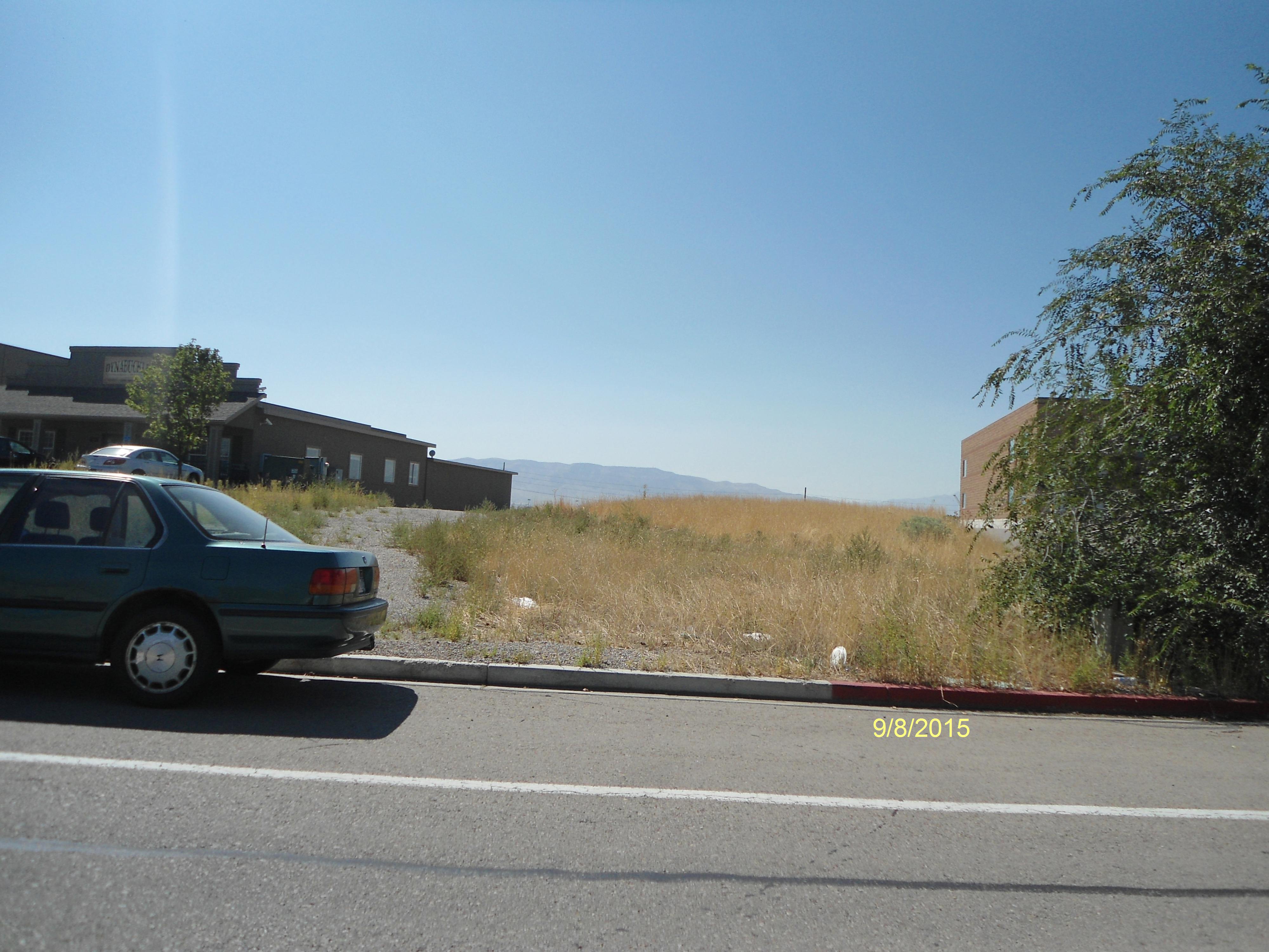
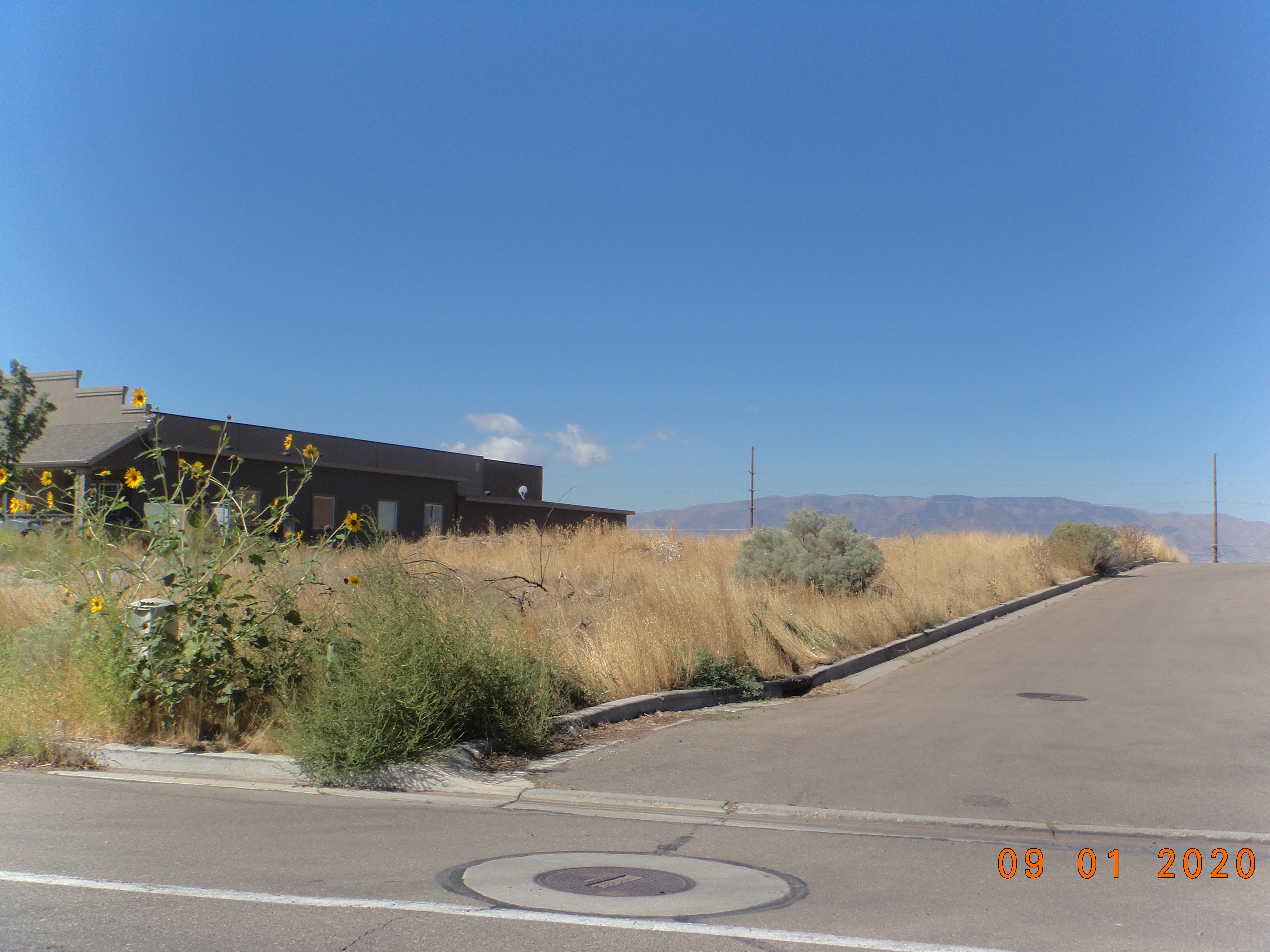
| Property Address: 701 N 1500 WEST - OREM |
|
| Mailing Address: 81 W 530 S OREM, UT 84058-3145 |
|
| Acreage: 0.591 |
|
| Last Document:
64586-2006
|
|
| Subdivision Map Filing |
|
| Taxing Description:
LOT 1, PLAT K, BUNKER BUSINESS PARK SUBDV. AREA 0.591 AC.
*Taxing description NOT FOR LEGAL DOCUMENTS
|
|
- Owner Names
- Value History
- Tax History
- Location
- Photos
- Documents
- Aerial Image
| |
----- Real Estate Values ----- |
---Improvements--- |
---Greenbelt--- |
Total |
| Year |
Com |
Res |
Agr |
Tot |
Com |
Res |
Agr |
Tot |
Land |
Homesite |
Tot |
Market Value |
| 2024 |
$296,300 |
$0 |
$0 |
$296,300 |
$0 |
$0 |
$0 |
$0 |
$0 |
$0 |
$0 |
$296,300 |
| 2023 |
$268,800 |
$0 |
$0 |
$268,800 |
$0 |
$0 |
$0 |
$0 |
$0 |
$0 |
$0 |
$268,800 |
| 2022 |
$255,000 |
$0 |
$0 |
$255,000 |
$0 |
$0 |
$0 |
$0 |
$0 |
$0 |
$0 |
$255,000 |
| 2021 |
$202,300 |
$0 |
$0 |
$202,300 |
$0 |
$0 |
$0 |
$0 |
$0 |
$0 |
$0 |
$202,300 |
| 2020 |
$224,300 |
$0 |
$0 |
$224,300 |
$0 |
$0 |
$0 |
$0 |
$0 |
$0 |
$0 |
$224,300 |
| 2019 |
$177,100 |
$0 |
$0 |
$177,100 |
$0 |
$0 |
$0 |
$0 |
$0 |
$0 |
$0 |
$177,100 |
| 2018 |
$161,200 |
$0 |
$0 |
$161,200 |
$0 |
$0 |
$0 |
$0 |
$0 |
$0 |
$0 |
$161,200 |
| 2017 |
$153,700 |
$0 |
$0 |
$153,700 |
$0 |
$0 |
$0 |
$0 |
$0 |
$0 |
$0 |
$153,700 |
| 2016 |
$146,500 |
$0 |
$0 |
$146,500 |
$0 |
$0 |
$0 |
$0 |
$0 |
$0 |
$0 |
$146,500 |
| 2015 |
$141,600 |
$0 |
$0 |
$141,600 |
$0 |
$0 |
$0 |
$0 |
$0 |
$0 |
$0 |
$141,600 |
| 2014 |
$134,900 |
$0 |
$0 |
$134,900 |
$0 |
$0 |
$0 |
$0 |
$0 |
$0 |
$0 |
$134,900 |
| 2013 |
$122,598 |
$0 |
$0 |
$122,598 |
$0 |
$0 |
$0 |
$0 |
$0 |
$0 |
$0 |
$122,598 |
| 2012 |
$122,598 |
$0 |
$0 |
$122,598 |
$0 |
$0 |
$0 |
$0 |
$0 |
$0 |
$0 |
$122,598 |
| 2011 |
$122,598 |
$0 |
$0 |
$122,598 |
$0 |
$0 |
$0 |
$0 |
$0 |
$0 |
$0 |
$122,598 |
| 2010 |
$122,598 |
$0 |
$0 |
$122,598 |
$0 |
$0 |
$0 |
$0 |
$0 |
$0 |
$0 |
$122,598 |
| 2009 |
$125,100 |
$0 |
$0 |
$125,100 |
$0 |
$0 |
$0 |
$0 |
$0 |
$0 |
$0 |
$125,100 |
| 2008 |
$107,900 |
$0 |
$0 |
$107,900 |
$0 |
$0 |
$0 |
$0 |
$0 |
$0 |
$0 |
$107,900 |
| 2007 |
$107,900 |
$0 |
$0 |
$107,900 |
$0 |
$0 |
$0 |
$0 |
$292 |
$0 |
$292 |
$107,900 |
| 2006 |
$89,898 |
$0 |
$0 |
$89,898 |
$0 |
$0 |
$0 |
$0 |
$286 |
$0 |
$286 |
$89,898 |
| 2005 |
$89,898 |
$0 |
$0 |
$89,898 |
$0 |
$0 |
$0 |
$0 |
$286 |
$0 |
$286 |
$89,898 |
| 2004 |
$89,898 |
$0 |
$0 |
$89,898 |
$0 |
$0 |
$0 |
$0 |
$289 |
$0 |
$289 |
$89,898 |
| Year |
General Taxes |
Adjustments |
Net Taxes |
Fees |
Payments |
Tax Balance* |
Balance Due |
Tax District |
| 2025 |
$0.00 |
$0.00 |
$0.00 |
$0.00 |
|
$0.00
|
$0.00 |
090 - OREM CITY |
| 2024 |
$0.00 |
$0.00 |
$0.00 |
$0.00 |
|
$0.00
|
$0.00 |
090 - OREM CITY |
| 2023 |
$2,045.30 |
$0.00 |
$2,045.30 |
$0.00 |
|
$0.00
|
$0.00 |
090 - OREM CITY |
| 2022 |
$2,002.77 |
$0.00 |
$2,002.77 |
$0.00 |
|
$0.00
|
$0.00 |
090 - OREM CITY |
| 2021 |
$1,907.28 |
$0.00 |
$1,907.28 |
$0.00 |
|
$0.00
|
$0.00 |
090 - OREM CITY |
| 2020 |
$2,151.71 |
$0.00 |
$2,151.71 |
$0.00 |
|
$0.00
|
$0.00 |
090 - OREM CITY |
| 2019 |
$1,633.75 |
$0.00 |
$1,633.75 |
$0.00 |
|
$0.00
|
$0.00 |
090 - OREM CITY |
| 2018 |
$1,556.39 |
$0.00 |
$1,556.39 |
$0.00 |
|
$0.00
|
$0.00 |
090 - OREM CITY |
| 2017 |
$1,523.63 |
$0.00 |
$1,523.63 |
$0.00 |
|
$0.00
|
$0.00 |
090 - OREM CITY |
| 2016 |
$1,574.88 |
$0.00 |
$1,574.88 |
$0.00 |
|
$0.00
|
$0.00 |
090 - OREM CITY |
| 2015 |
$1,609.57 |
$0.00 |
$1,609.57 |
$0.00 |
|
$0.00
|
$0.00 |
090 - OREM CITY |
| 2014 |
$1,540.42 |
$0.00 |
$1,540.42 |
$0.00 |
|
$0.00
|
$0.00 |
090 - OREM CITY |
| 2013 |
$1,509.67 |
$0.00 |
$1,509.67 |
$0.00 |
|
$0.00
|
$0.00 |
090 - OREM CITY |
| 2012 |
$1,540.81 |
$0.00 |
$1,540.81 |
$0.00 |
|
$0.00
|
$0.00 |
090 - OREM CITY |
| 2011 |
$1,533.46 |
$0.00 |
$1,533.46 |
$0.00 |
|
$0.00
|
$0.00 |
090 - OREM CITY |
| 2010 |
$1,435.62 |
$0.00 |
$1,435.62 |
$0.00 |
|
$0.00
|
$0.00 |
090 - OREM CITY |
| 2009 |
$1,357.96 |
$0.00 |
$1,357.96 |
$0.00 |
|
$0.00
|
$0.00 |
090 - OREM CITY |
| 2008 |
$1,085.37 |
$0.00 |
$1,085.37 |
$0.00 |
|
$0.00
|
$0.00 |
090 - OREM CITY |
| 2007 |
$2.90 |
$0.00 |
$2.90 |
$0.00 |
|
$0.00
|
$0.00 |
090 - OREM CITY |
| 2006 |
$3.03 |
$0.00 |
$3.03 |
$0.00 |
|
$0.00
|
$0.00 |
090 - OREM CITY |
| 2005 |
$3.42 |
$0.00 |
$3.42 |
$0.00 |
|
$0.00
|
$0.00 |
090 - OREM CITY |
| 2004 |
$3.39 |
$0.00 |
$3.39 |
$0.00 |
|
$0.00
|
$0.00 |
090 - OREM CITY |
* Note: Original tax amount (Does not include applicable interest and/or fees).
| Entry # |
Date |
Recorded |
Type |
Party1 (Grantor) |
Party2 (Grantee) |
| 16048-2013 |
02/12/2013 |
02/20/2013 |
NI |
RABI LLC |
WHOM OF INTEREST |
| 117880-2009 |
11/13/2009 |
11/13/2009 |
R FARM |
UTAH COUNTY TREASURER |
BUNKER, ANTOINE L (ET AL) |
| 40866-2008 |
04/07/2008 |
04/07/2008 |
WD |
KAY KEN PROPERTIES LLC |
KAY KEN HOLDINGS LLC |
| 115676-2007 |
08/08/2007 |
08/08/2007 |
W FARM |
UTAH COUNTY ASSESSOR |
WHOM OF INTEREST |
| 64586-2006 |
05/15/2006 |
05/24/2006 |
WD |
TENT PEG LC |
KAY KEN PROPERTIES LLC |
| 2882-2006 |
01/09/2006 |
01/09/2006 |
REC |
BANK OF AMERICAN FORK TEE |
CARTER CONSTRUCTION COMPANY |
| 185274-2003 |
11/21/2003 |
11/21/2003 |
S PLAT |
TENT PEG LC |
BUNKER BUSINESS PARK PLAT K |
Main Menu Comments or Concerns on Value/Appraisal - Assessor's Office
Documents/Owner/Parcel information - Recorder's Office
Address Change for Tax Notice
This page was created on 5/16/2024 8:27:20 PM |