Property Information
mobile view
| Serial Number: 17:013:0111 |
Serial Life: 1994-2003 |
|
|
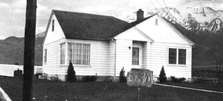
Total Photos: 1
|
| |
|
|
| Property Address: 286 W 1200 NORTH - OREM |
|
| Mailing Address: 475 W 1400 N PLEASANT GROVE, UT 84062 |
|
| Acreage: 0.968 |
|
| Last Document:
84595-2002
|
|
| Subdivision Map Filing |
|
| Taxing Description:
COM N 28.6 FT & E 730.74 FT FR S 1/4 COR. SEC. 3, T6S, R2E, SLB&M.; N 1 DEG 8' 0" W 335.36 FT; S 89 DEG 28' 27" E 3.27 FT; S 89 DEG 42' 26" E 122.64 FT; S 1 DEG 8' 0" E 334.6 FT; S 89 DEG 55' 18" W 68.33 FT; S 89 DEG 59' 23" W 57.57 FT TO BEG. AREA 0.968 AC.
*Taxing description NOT FOR LEGAL DOCUMENTS
|
|
- Owner Names
- Value History
- Tax History
- Location
- Photos
- Documents
- Aerial Image
| |
----- Real Estate Values ----- |
---Improvements--- |
---Greenbelt--- |
Total |
| Year |
Com |
Res |
Agr |
Tot |
Com |
Res |
Agr |
Tot |
Land |
Homesite |
Tot |
Market Value |
| 2003 |
$0 |
$84,659 |
$0 |
$84,659 |
$0 |
$66,511 |
$0 |
$66,511 |
$0 |
$0 |
$0 |
$151,170 |
| 2002 |
$0 |
$84,659 |
$0 |
$84,659 |
$0 |
$66,511 |
$0 |
$66,511 |
$0 |
$0 |
$0 |
$151,170 |
| 2001 |
$0 |
$84,659 |
$0 |
$84,659 |
$0 |
$66,511 |
$0 |
$66,511 |
$0 |
$0 |
$0 |
$151,170 |
| 2000 |
$0 |
$79,121 |
$0 |
$79,121 |
$0 |
$59,592 |
$0 |
$59,592 |
$0 |
$0 |
$0 |
$138,713 |
| 1999 |
$0 |
$73,945 |
$0 |
$73,945 |
$0 |
$55,693 |
$0 |
$55,693 |
$0 |
$0 |
$0 |
$129,638 |
| 1998 |
$0 |
$73,945 |
$0 |
$73,945 |
$0 |
$55,693 |
$0 |
$55,693 |
$0 |
$0 |
$0 |
$129,638 |
| 1997 |
$0 |
$73,945 |
$0 |
$73,945 |
$0 |
$55,693 |
$0 |
$55,693 |
$0 |
$0 |
$0 |
$129,638 |
| 1996 |
$0 |
$60,690 |
$0 |
$60,690 |
$0 |
$45,710 |
$0 |
$45,710 |
$0 |
$0 |
$0 |
$106,400 |
| 1995 |
$0 |
$55,173 |
$0 |
$55,173 |
$0 |
$45,710 |
$0 |
$45,710 |
$0 |
$0 |
$0 |
$100,883 |
| 1994 |
$0 |
$32,265 |
$0 |
$32,265 |
$0 |
$36,863 |
$0 |
$36,863 |
$0 |
$0 |
$0 |
$69,128 |
| Year |
General Taxes |
Adjustments |
Net Taxes |
Fees |
Payments |
Tax Balance* |
Balance Due |
Tax District |
| 2003 |
$947.17 |
$0.00 |
$947.17 |
$0.00 |
|
$0.00
|
$0.00 |
090 - OREM CITY |
| 2002 |
$865.60 |
$0.00 |
$865.60 |
$0.00 |
|
$0.00
|
$0.00 |
090 - OREM CITY |
| 2001 |
$857.29 |
$0.00 |
$857.29 |
$0.00 |
|
$0.00
|
$0.00 |
090 - OREM CITY |
| 2000 |
$813.36 |
$0.00 |
$813.36 |
$0.00 |
|
$0.00
|
$0.00 |
090 - OREM CITY |
| 1999 |
$782.60 |
$0.00 |
$782.60 |
$0.00 |
|
$0.00
|
$0.00 |
090 - OREM CITY |
| 1998 |
$738.96 |
$0.00 |
$738.96 |
$0.00 |
|
$0.00
|
$0.00 |
090 - OREM CITY |
| 1997 |
$735.90 |
$0.00 |
$735.90 |
$0.00 |
|
$0.00
|
$0.00 |
090 - OREM CITY |
| 1996 |
$551.79 |
$0.00 |
$551.79 |
$0.00 |
|
$0.00
|
$0.00 |
090 - OREM CITY |
| 1995 |
$592.04 |
$0.00 |
$592.04 |
$0.00 |
|
$0.00
|
$0.00 |
090 - OREM CITY |
| 1994 |
$646.35 |
$0.00 |
$646.35 |
$0.00 |
|
$0.00
|
$0.00 |
090 - OREM CITY |
* Note: Original tax amount (Does not include applicable interest and/or fees).
| Entry # |
Date |
Recorded |
Type |
Party1 (Grantor) |
Party2 (Grantee) |
| 180873-2003 |
10/27/2003 |
11/14/2003 |
S PLAT |
FAIRBANKS, WILLIAM M (ET AL) |
JOHNSON'S ACRE PLAT A |
| 107571-2002 |
09/12/2002 |
09/13/2002 |
D TR |
CARTER, DENNIS B |
WESTERN COMMUNITY BANK |
| 107570-2002 |
|
09/13/2002 |
WD |
CARTER CONSTRUCTION COMPANY |
CARTER, DENNIS B |
| 84595-2002 |
07/23/2002 |
07/25/2002 |
WD |
JOHNSON, LINDA LOU |
CARTER CONSTRUCTION COMPANY |
| 95716-1993 |
12/17/1993 |
12/30/1993 |
DEDPLAT |
LEAVITT, WAYNE & PEGGY (ET AL) |
1200 N STATE ST TO 100 W STREET DEDICATION |
Main Menu Comments or Concerns on Value/Appraisal - Assessor's Office
Documents/Owner/Parcel information - Recorder's Office
Address Change for Tax Notice
This page was created on 4/18/2024 8:15:58 PM |